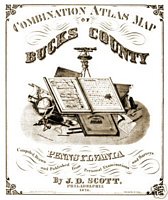
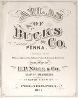
Bucks
County Maps from the James D. Scott 1876 Atlas
Atlas
was created for the centennial in 1876 and it was used as advertising
for
people who chose to place scenes of their business and farms. (Alphabetical
Order, followed by PA, U.S., & World maps from within the Atlas) Click
on each Map for enlarged image.
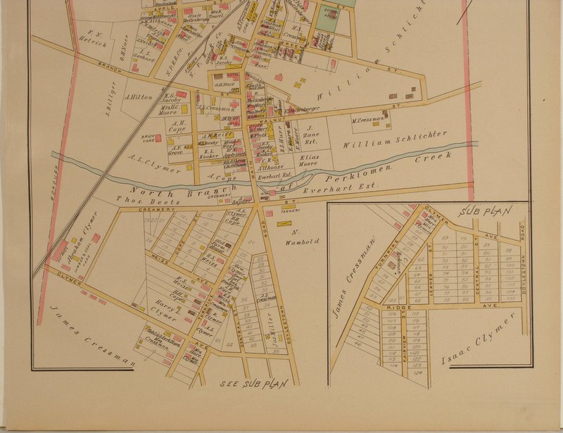
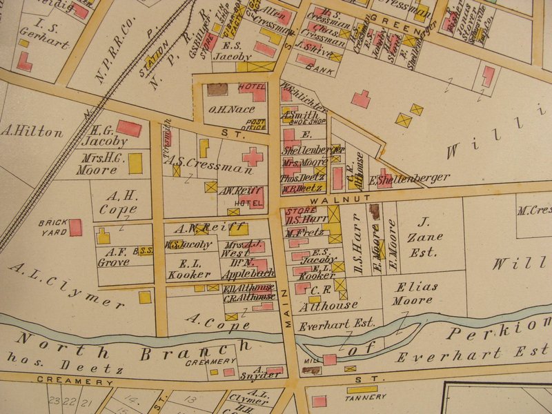
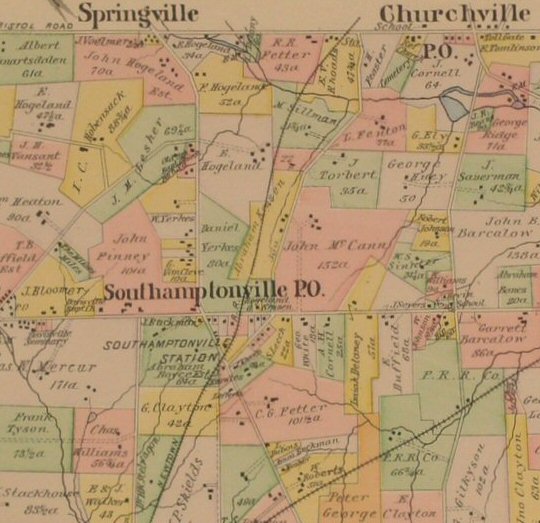
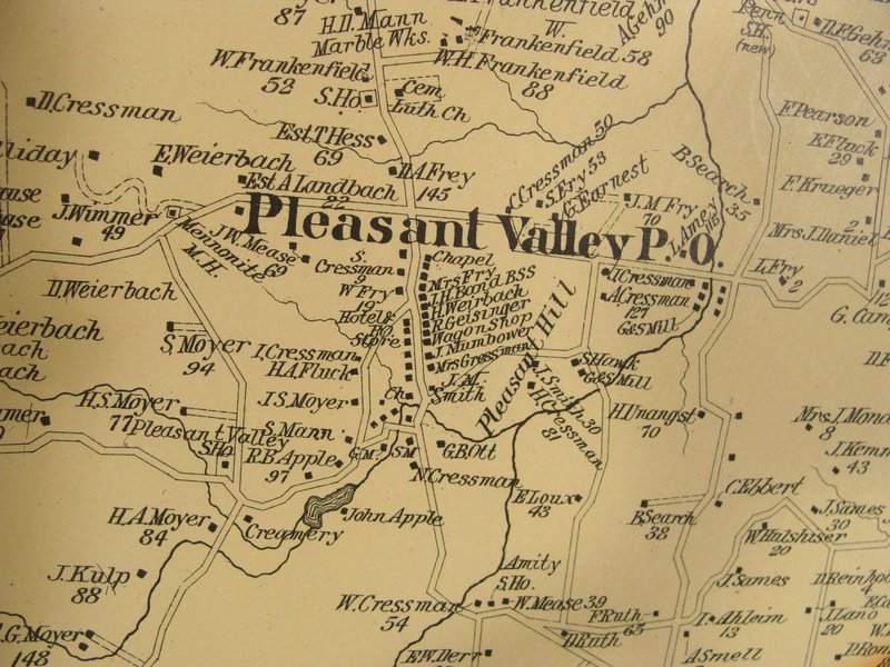
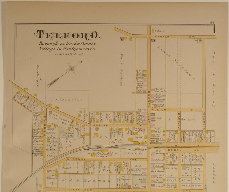
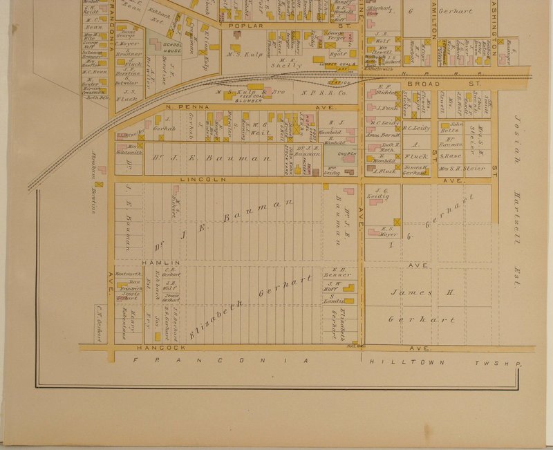
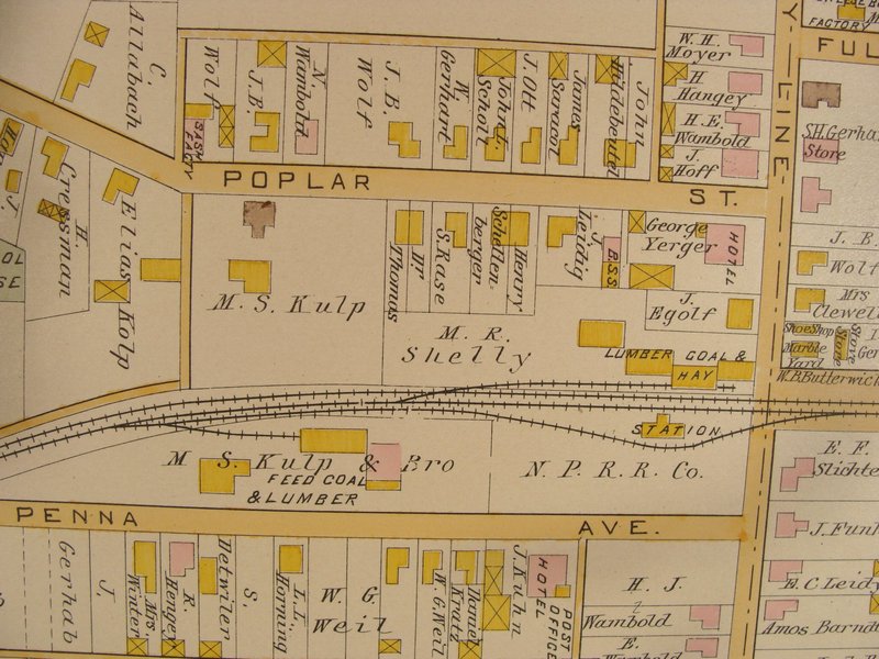
Each
of the vertically-oriented photos are provided with upper and lower half close-ups,
and all maps have a link to view a close-up section of the minute detail. Click
here for Sizes, Condition, and Prices
Please
call either 215-598-3662 or 215-321-1277,
or e-mail
for further information.
Or, send a fax (215-598-3966) with specific questions. |
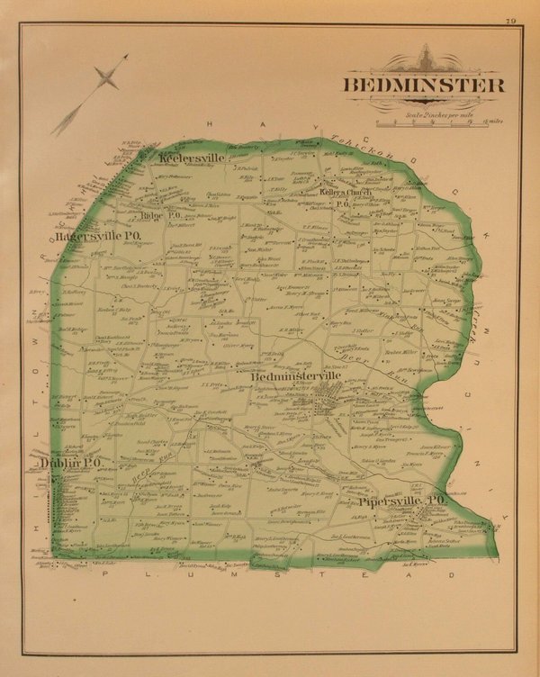
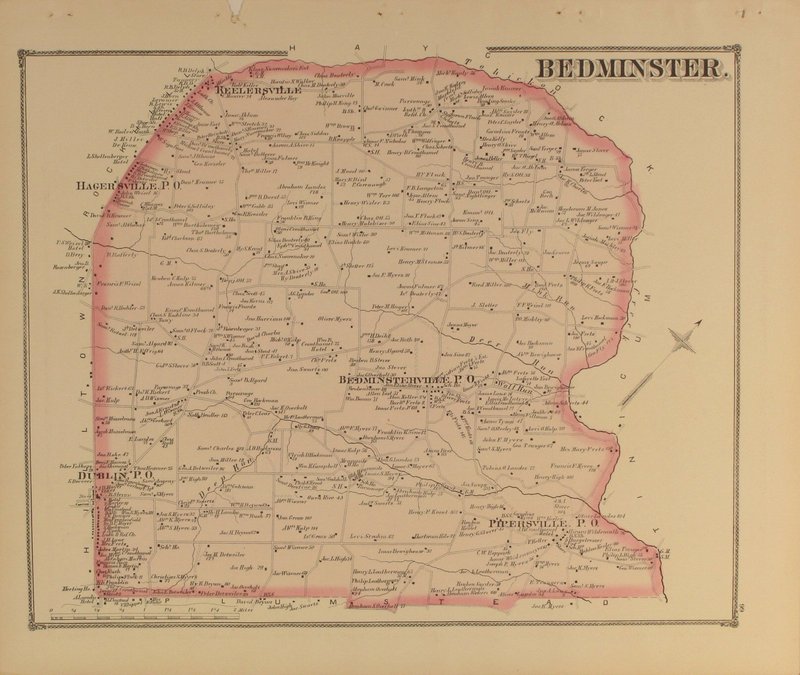
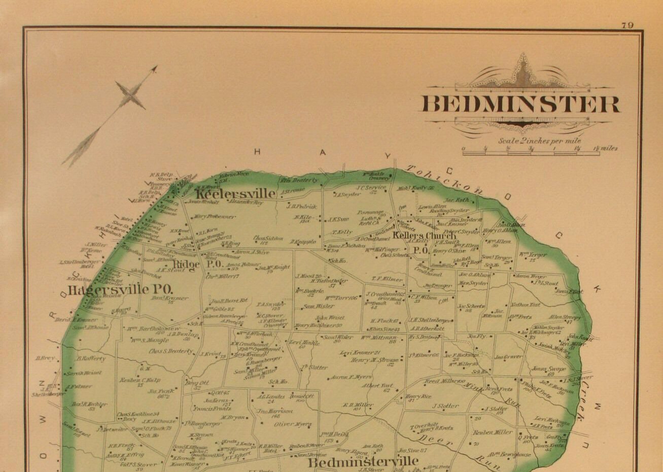
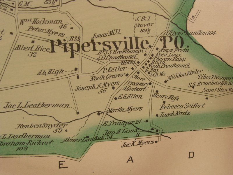
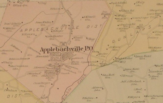
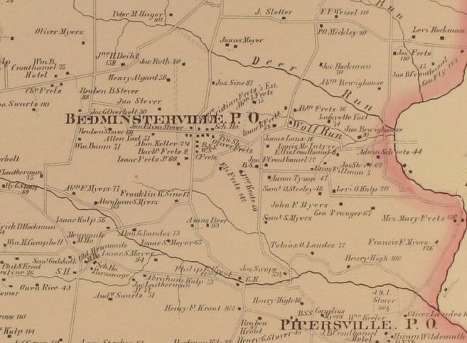
Bedminster 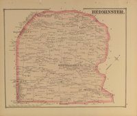
Click
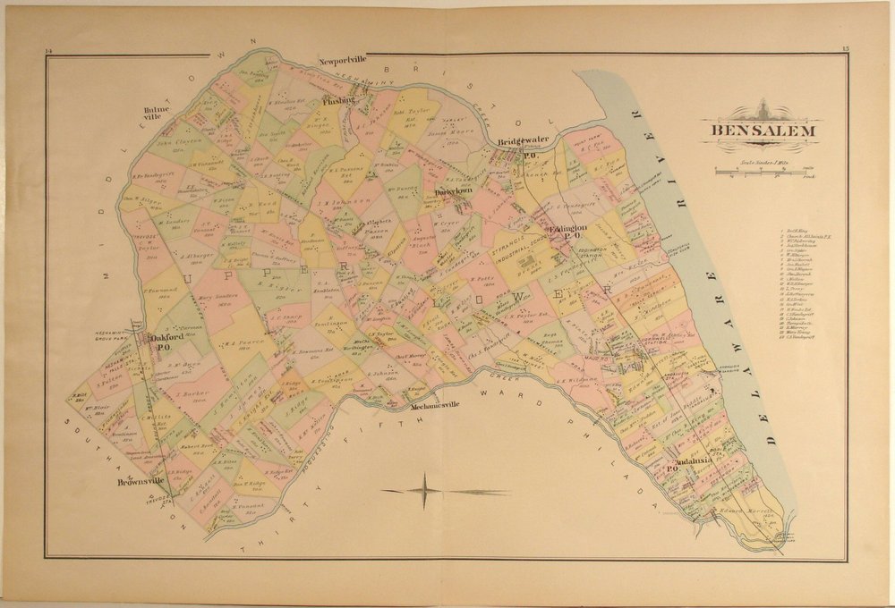
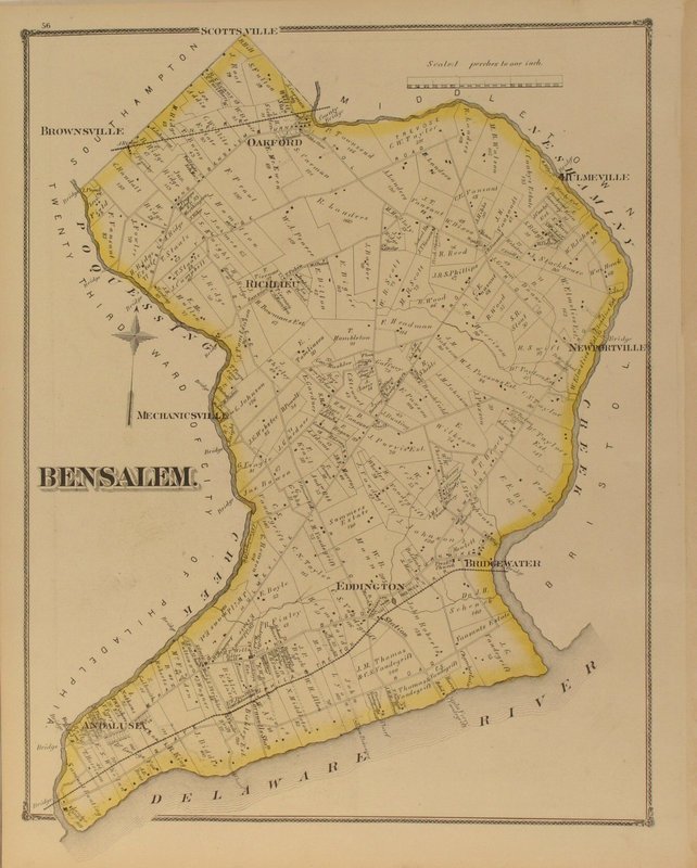
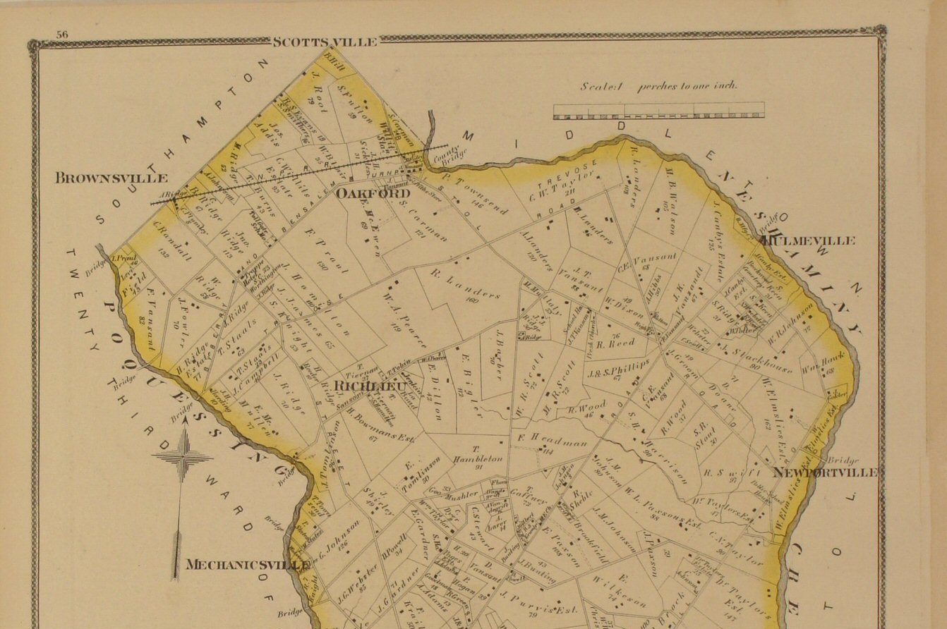
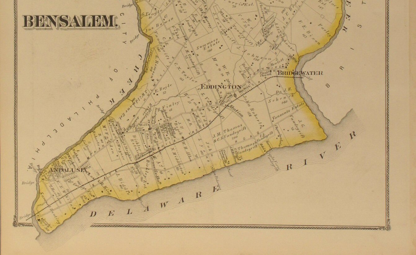
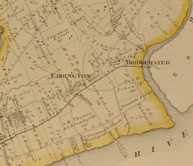
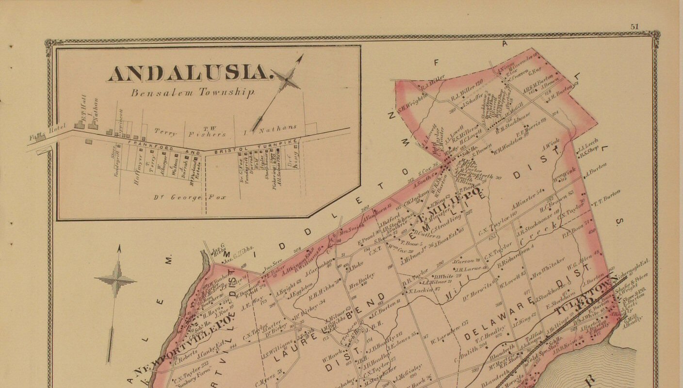
to view close-up section of the map detail. | Bensalem 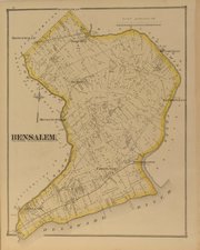
Click
to view top half of map.
Click
to view lower half of map.
Click
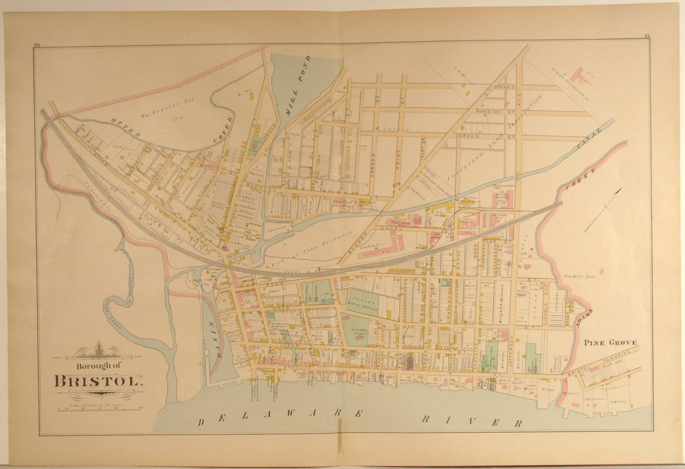
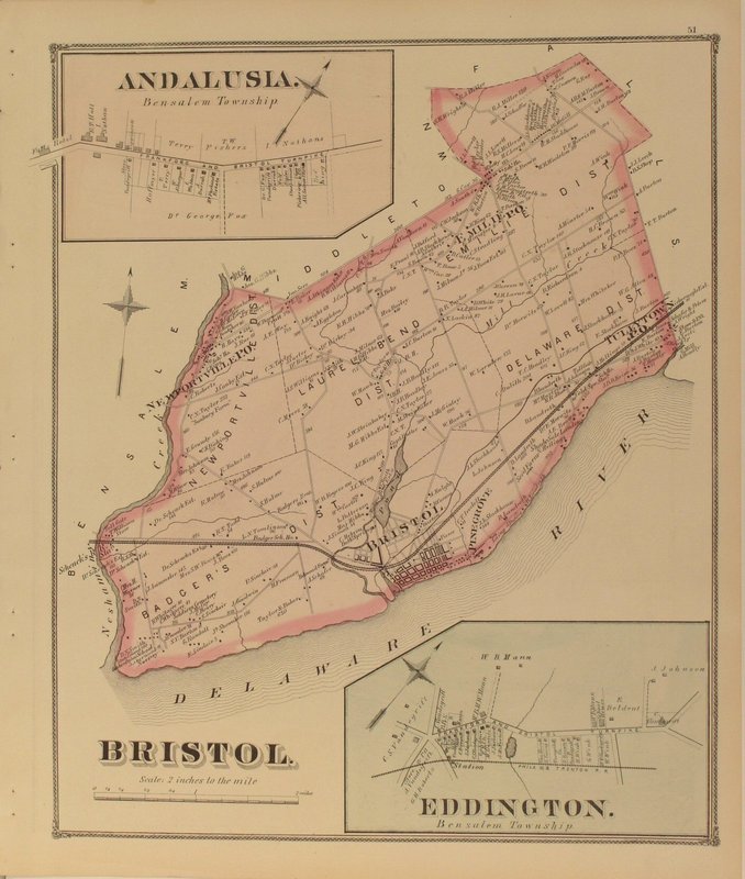
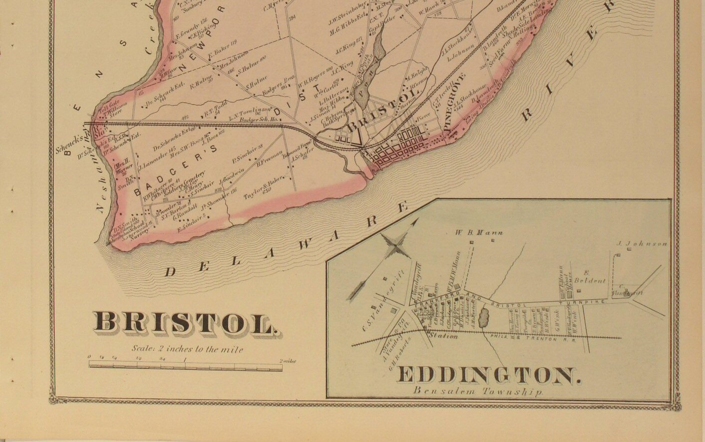
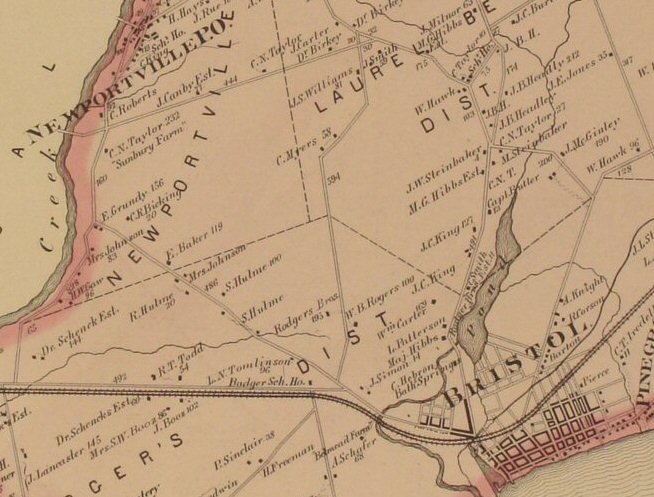
to view close-up section of the map detail. | Bristol 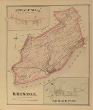
Click to view top half of map.
Click
to view lower half of map.
Click
to view close-up section of the map detail. |
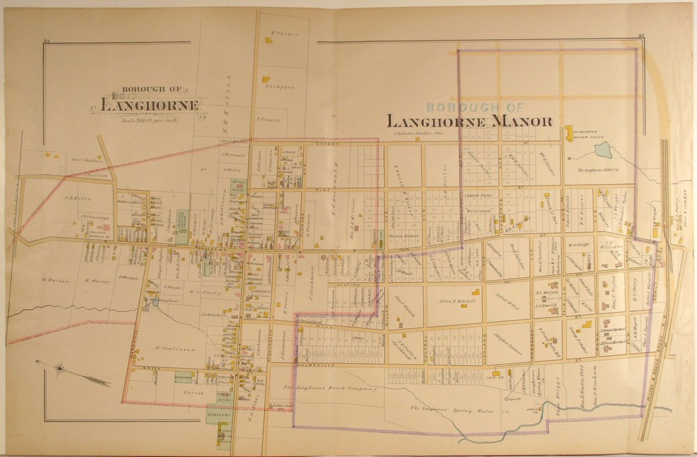
Bristol
Borough (to
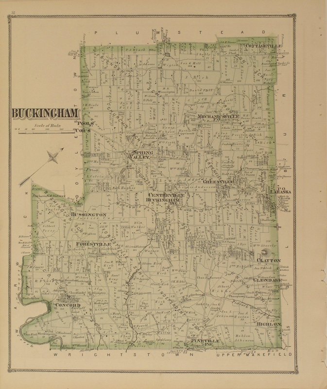
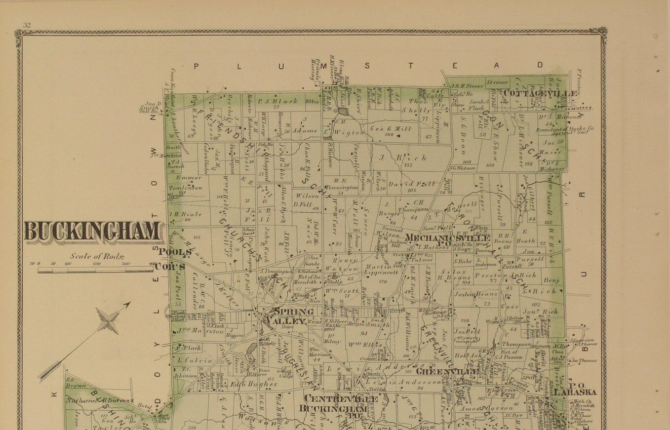
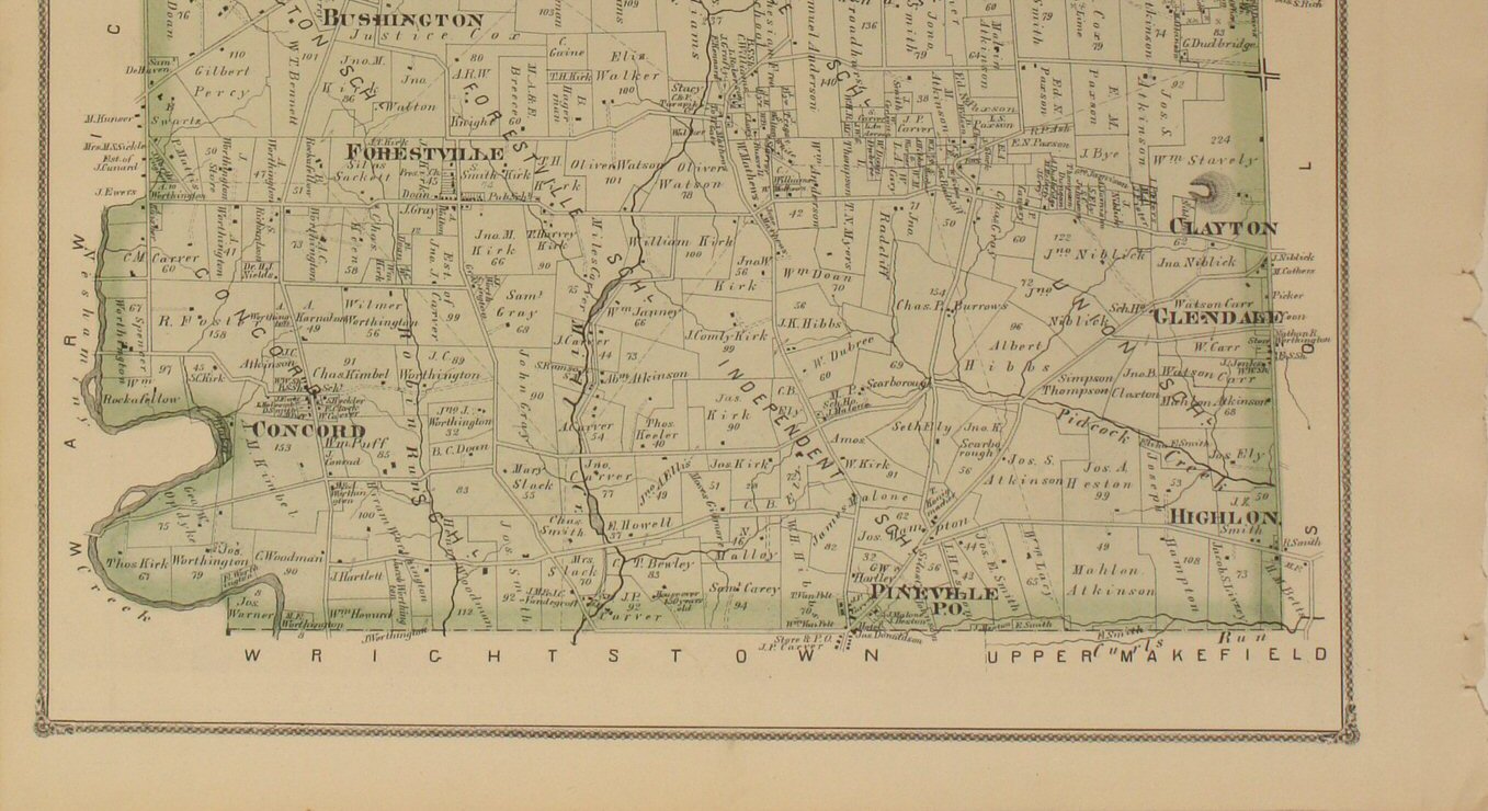
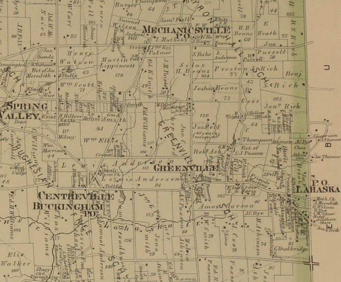
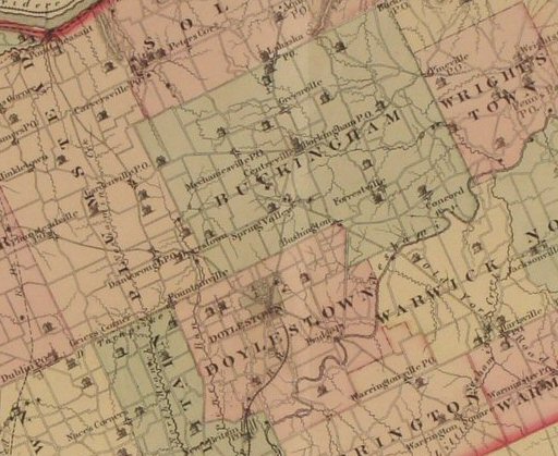
be added...please check back) | Buckingham 
Click
to view top half of map.
Click
to view lower half of map.
Click
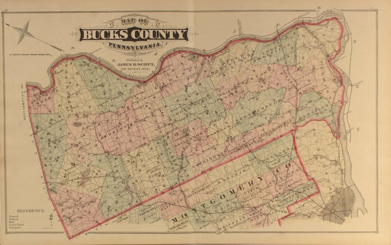
to view close-up section of the map detail. | Bucks
County 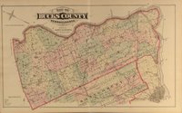
Click
to view close-up section of the map detail. |
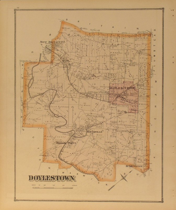
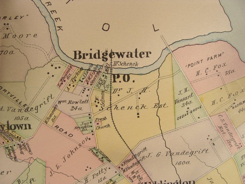
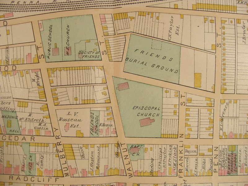
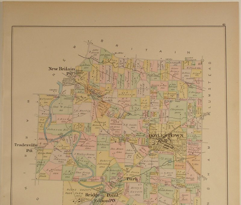
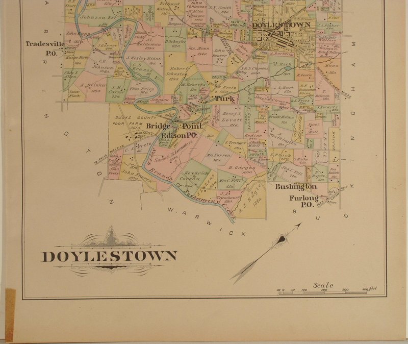
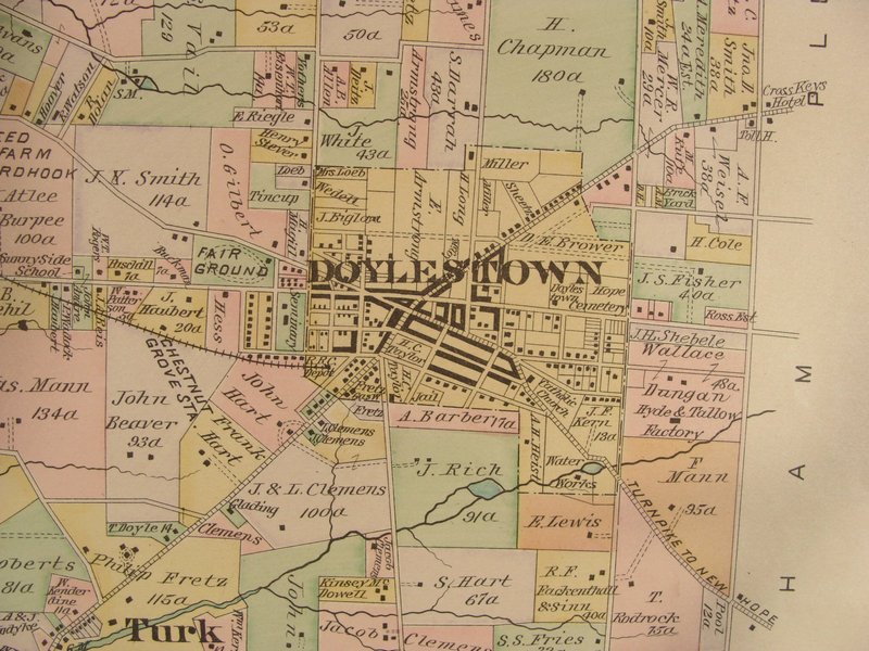
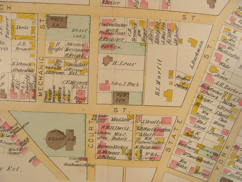
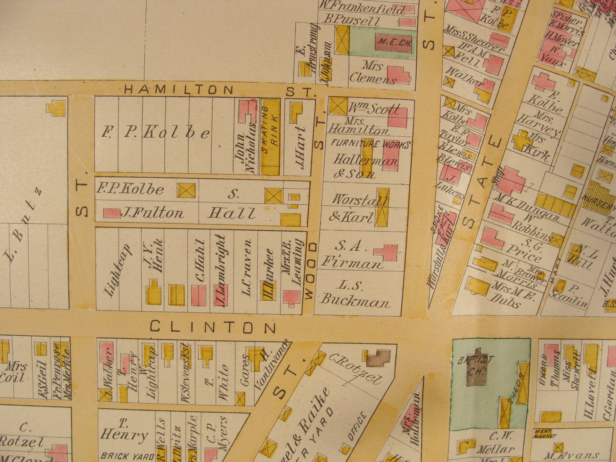
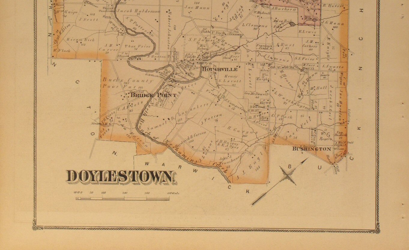
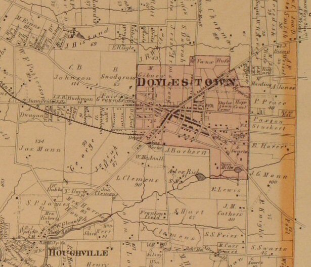
Doylestown 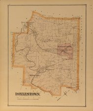
Click
to view top half of map.
Click
to view lower half of map.
Click
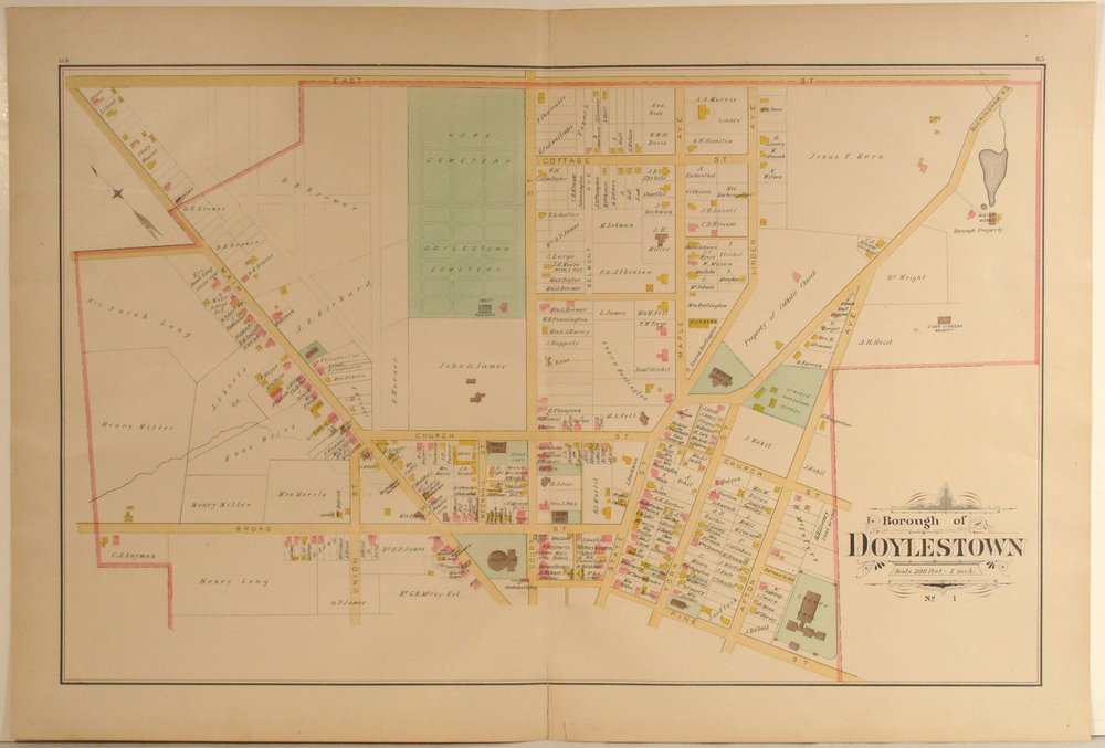
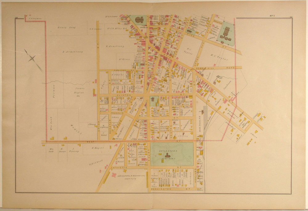
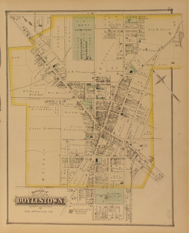
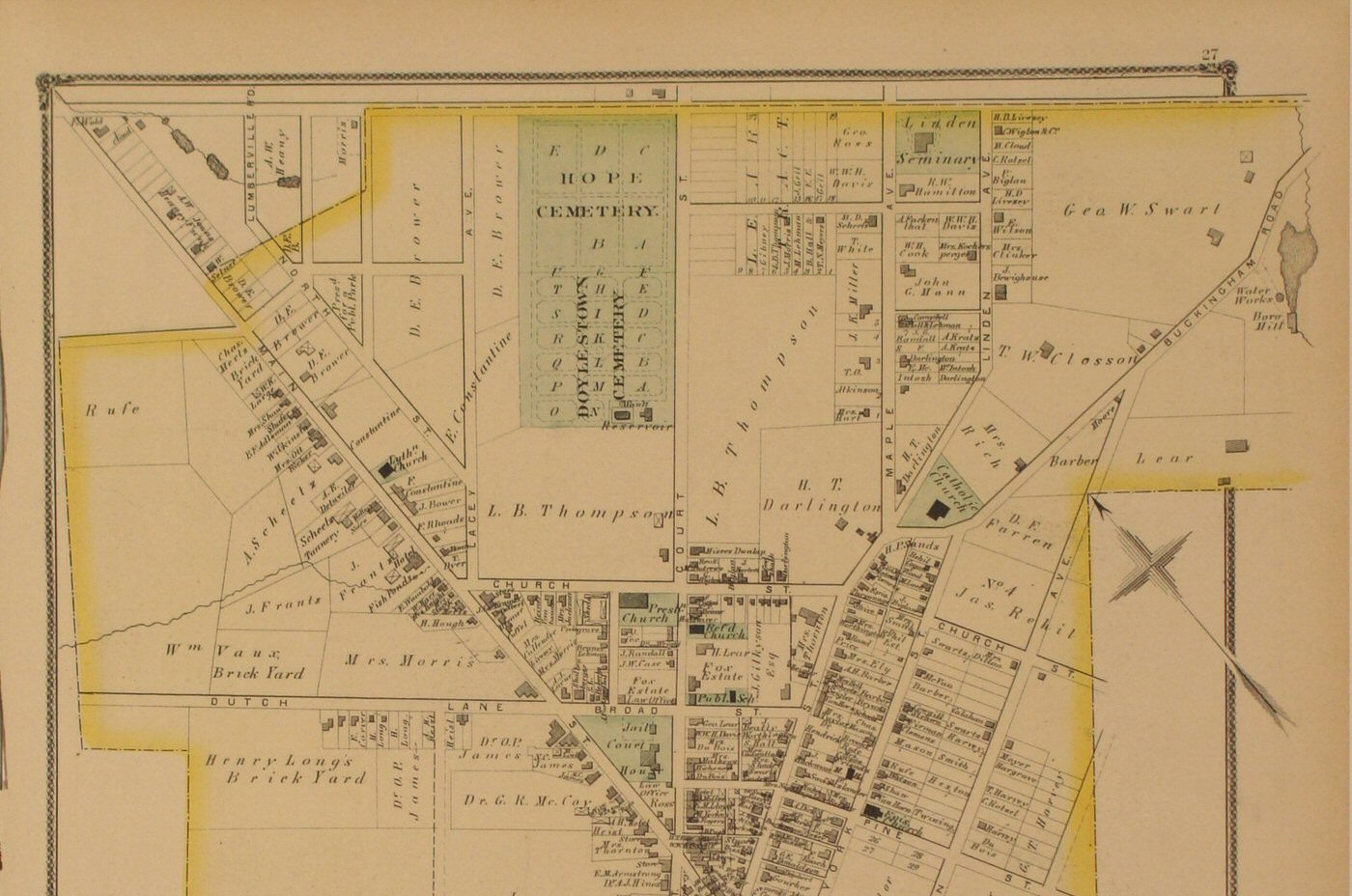
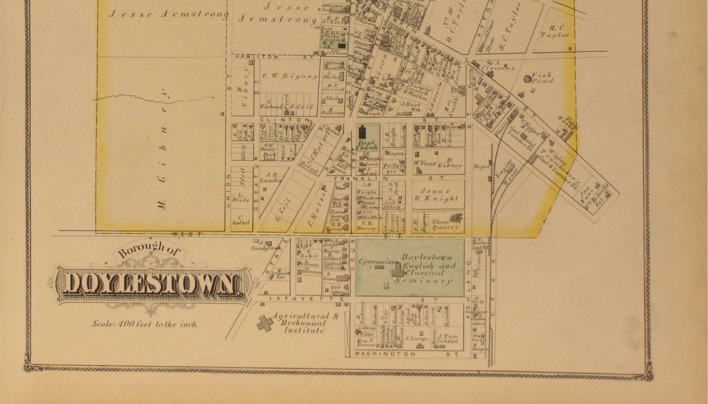
to view close-up section of the map detail. | Doylestown
Boro 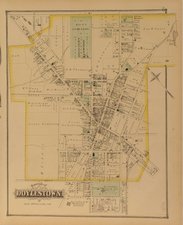
Click
to view top half of map.
Click
to view lower half of map.
Click
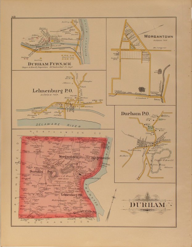
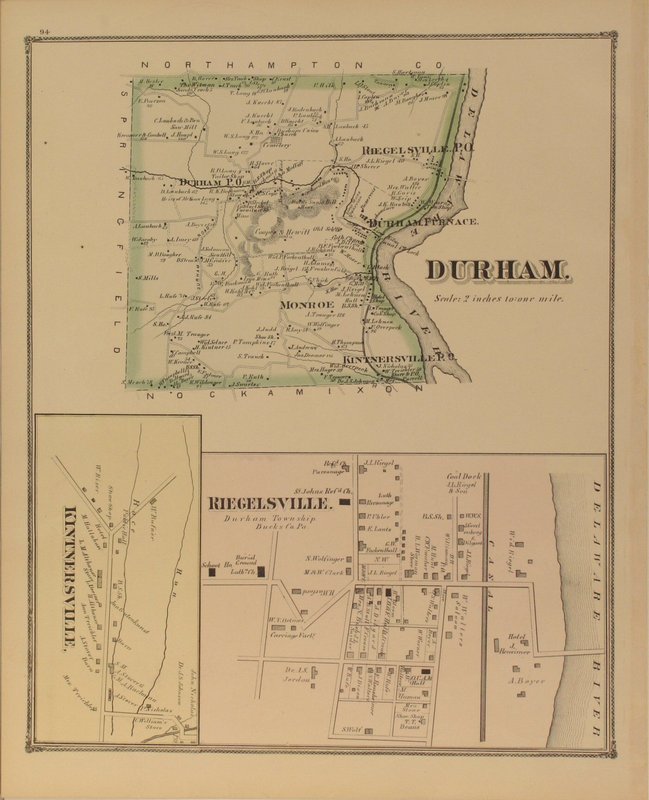
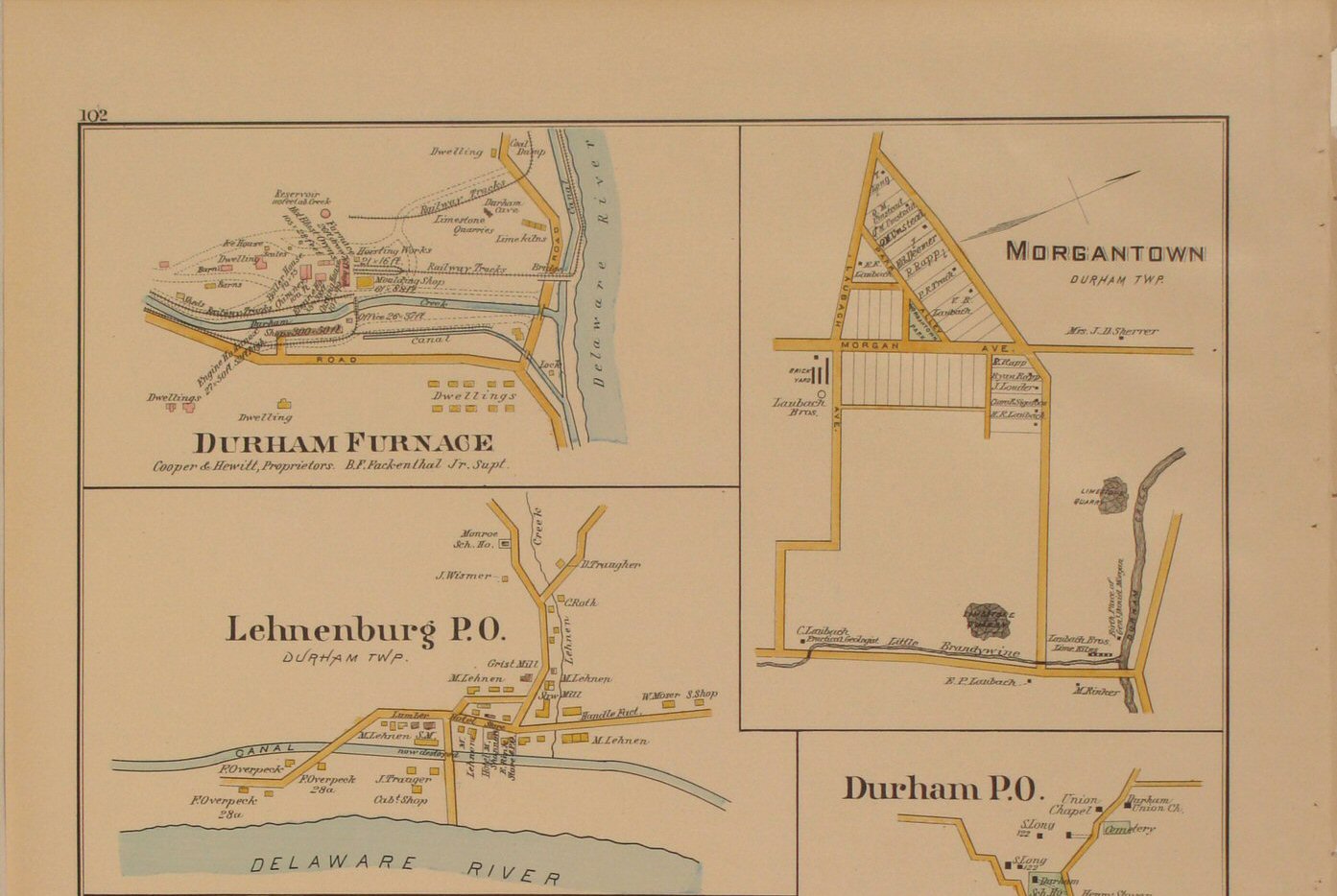
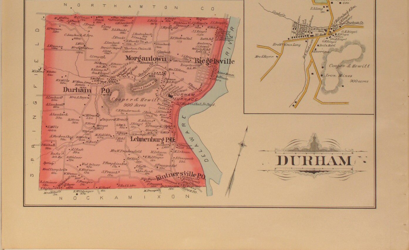
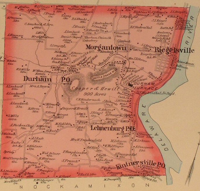
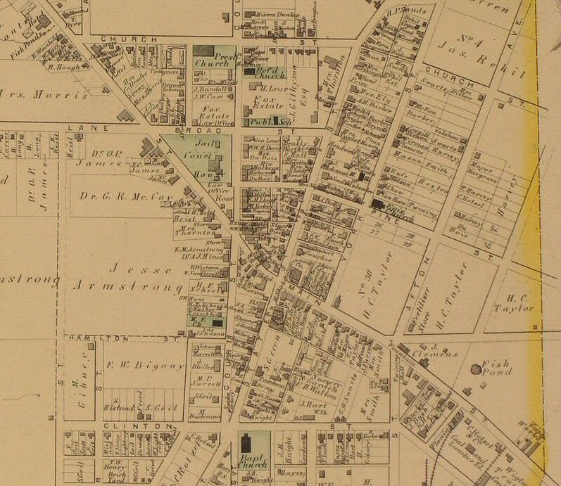
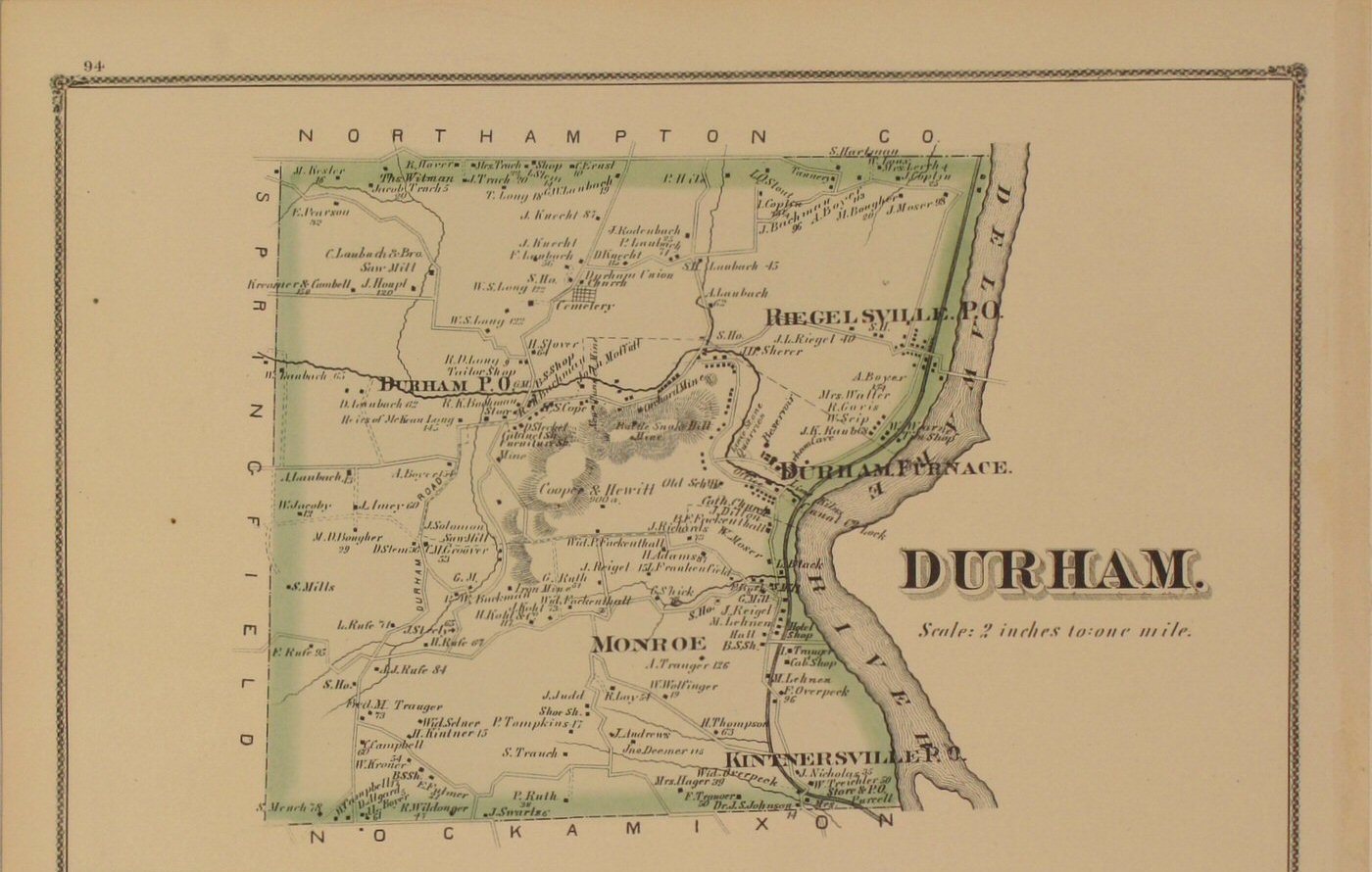
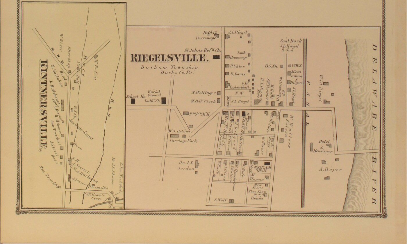
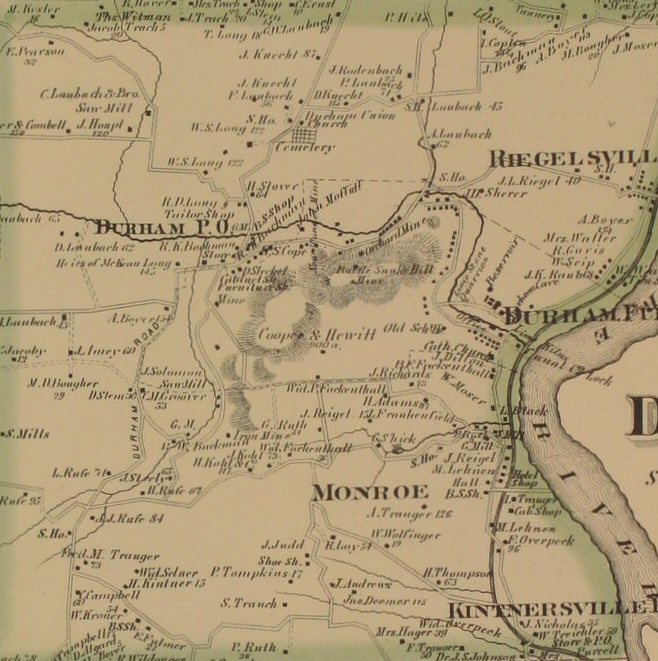
to view close-up section of the map detail. | Durham 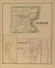
Click
to view top half of map.
Click
to view lower half of map.
Click
to view close-up section of the map detail. |
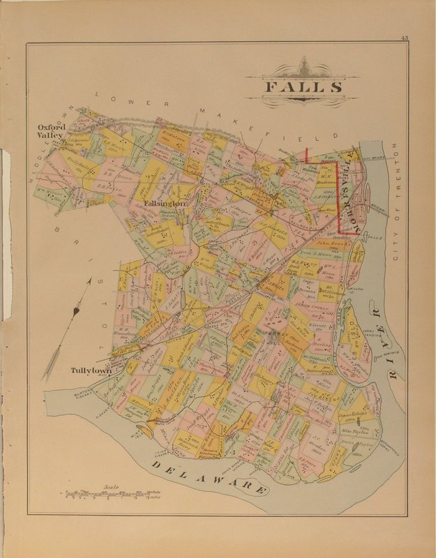
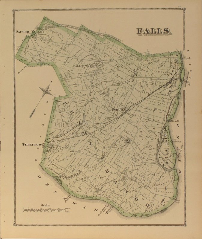
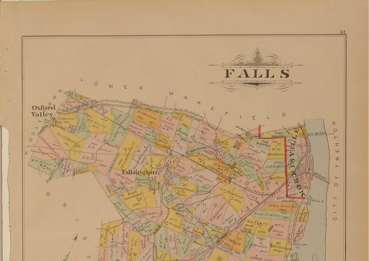
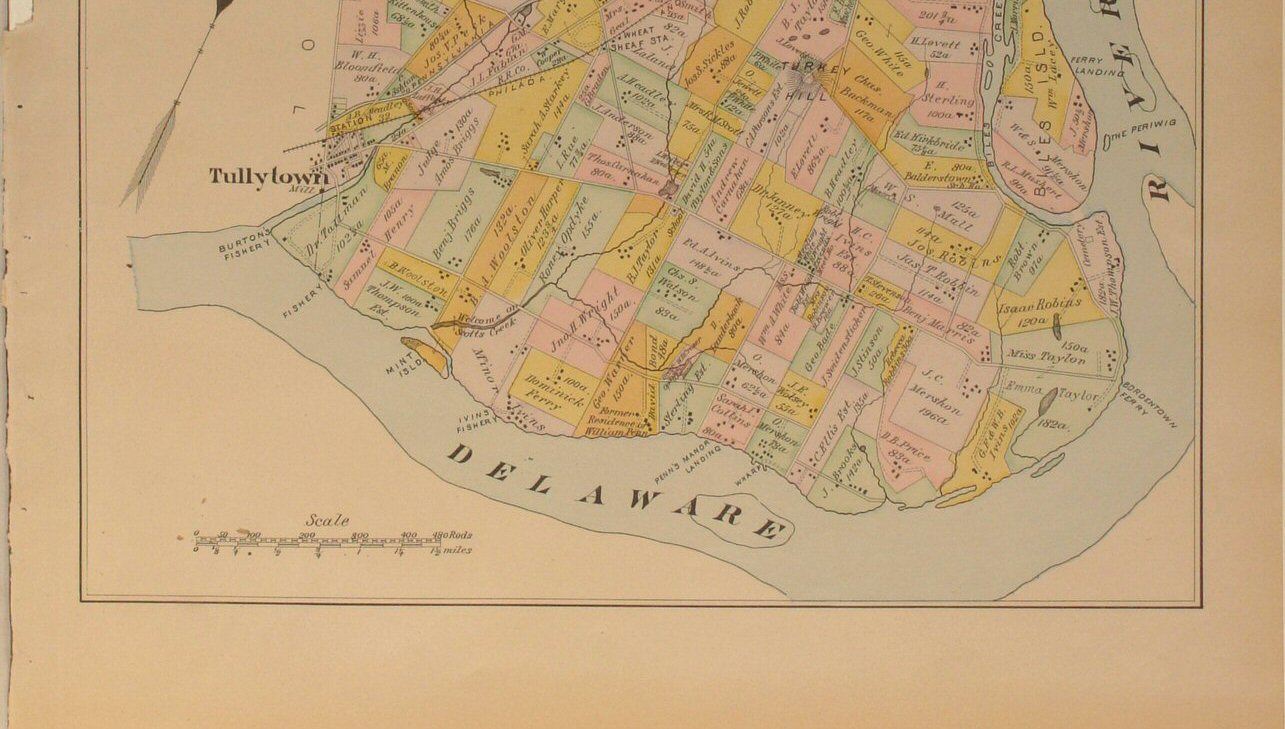
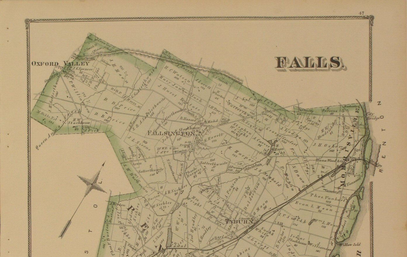
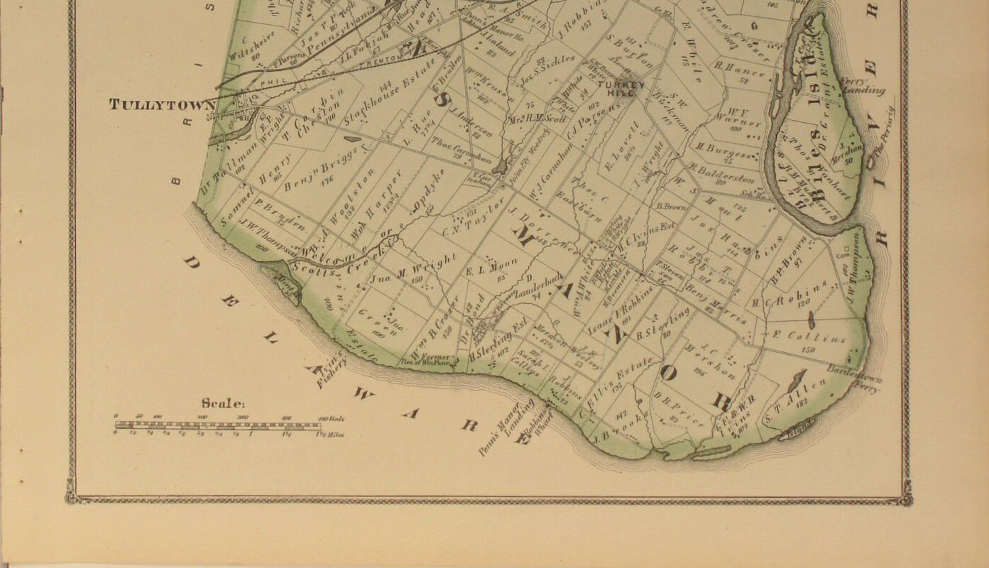
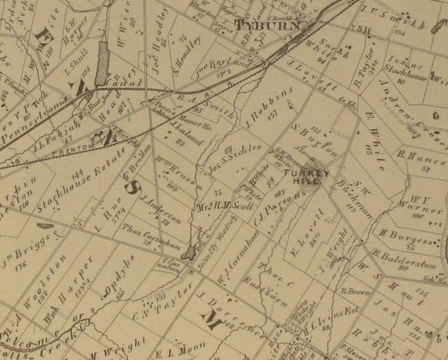
Falls 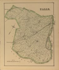
Click
to view top half of map.
Click
to view lower half of map.
Click
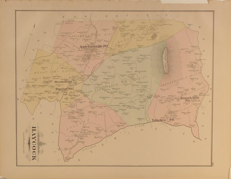
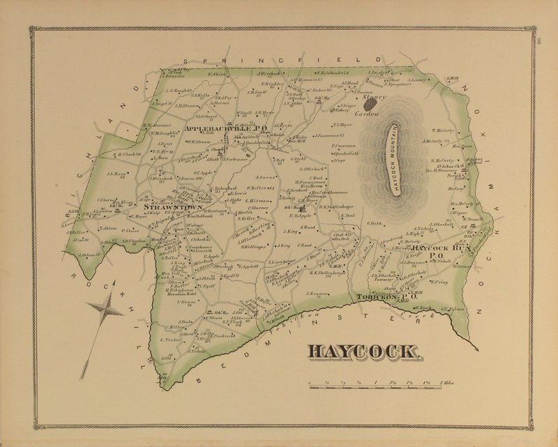
to view close-up section of the map detail. | Haycock 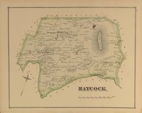
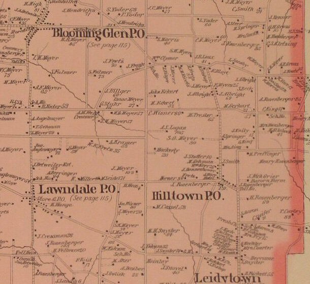
Click
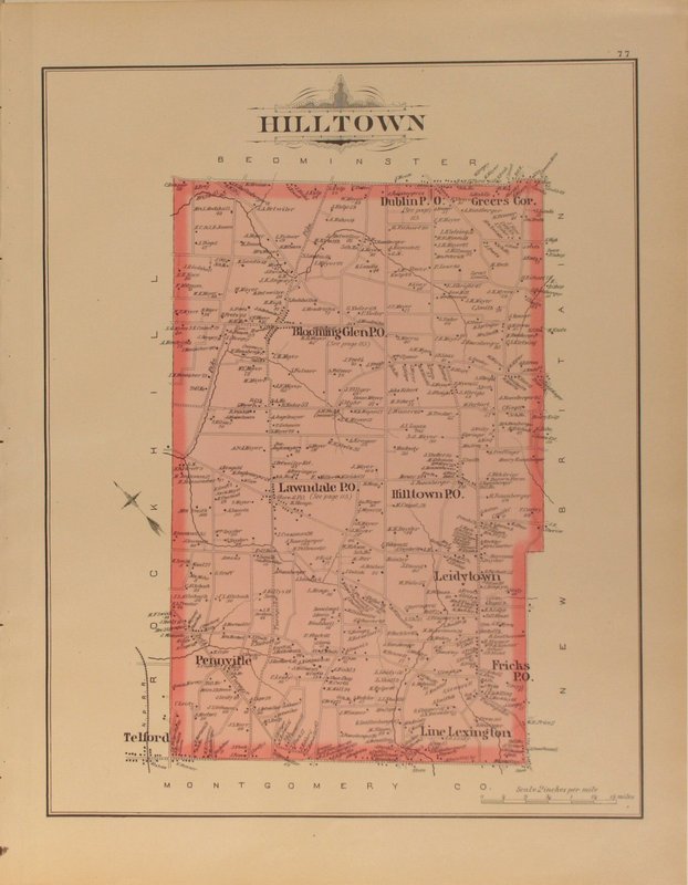
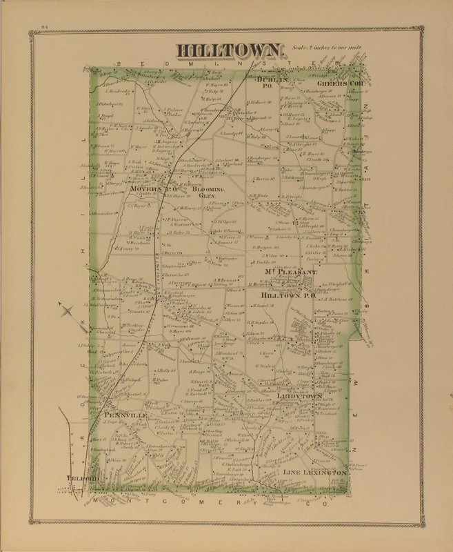
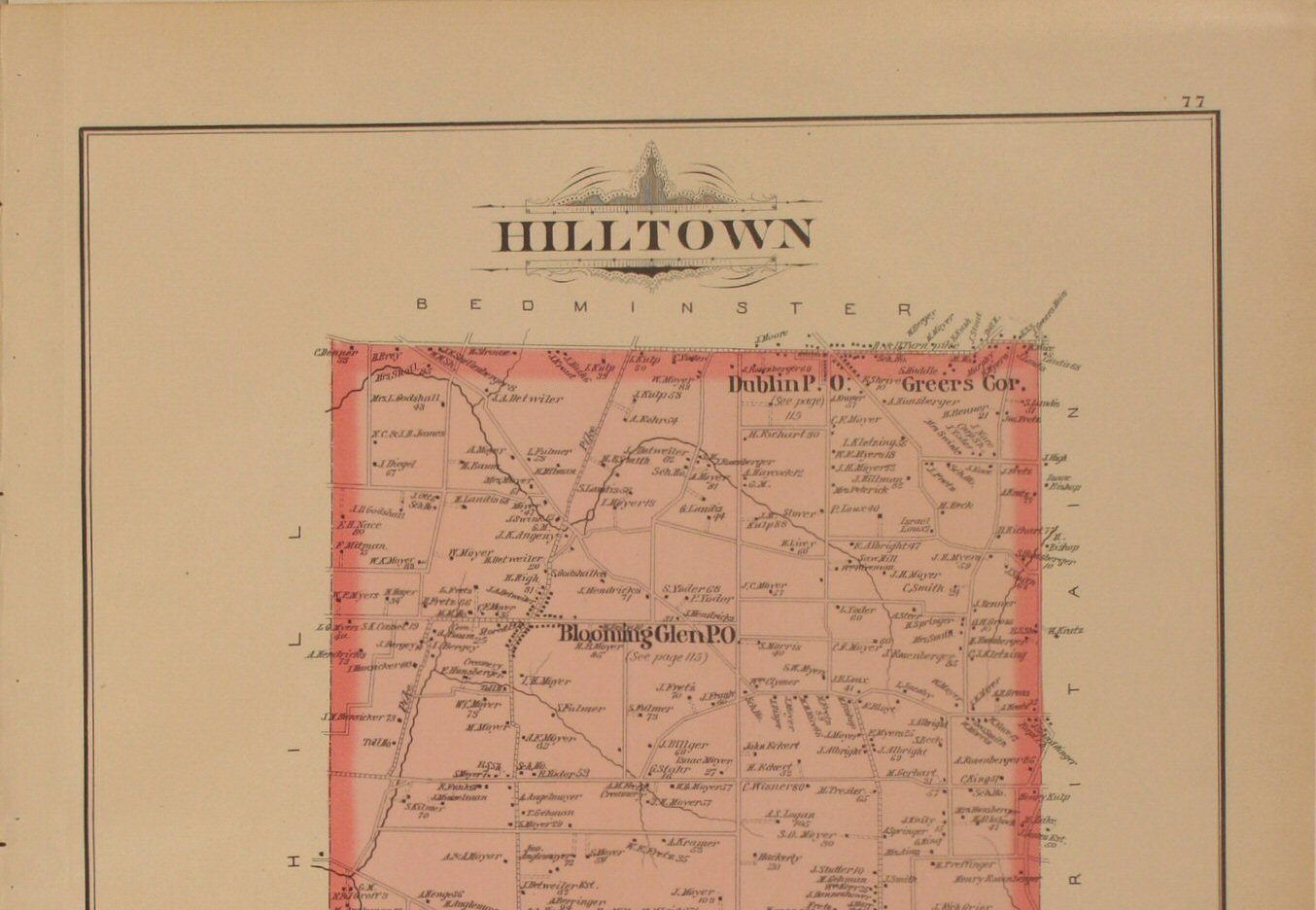
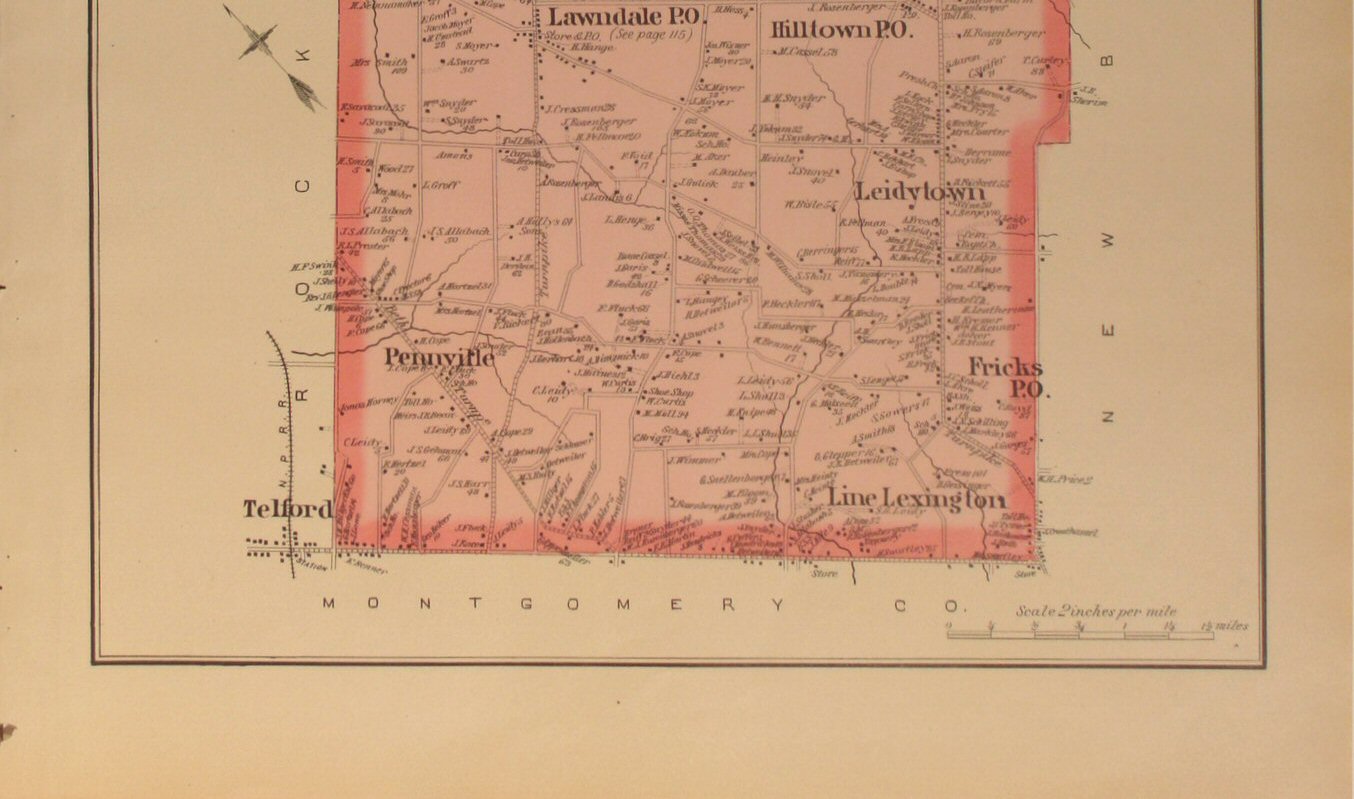
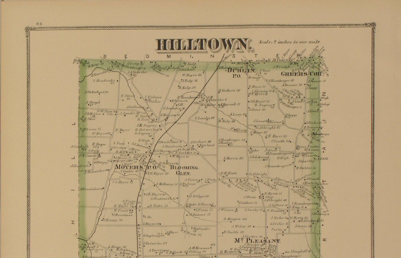
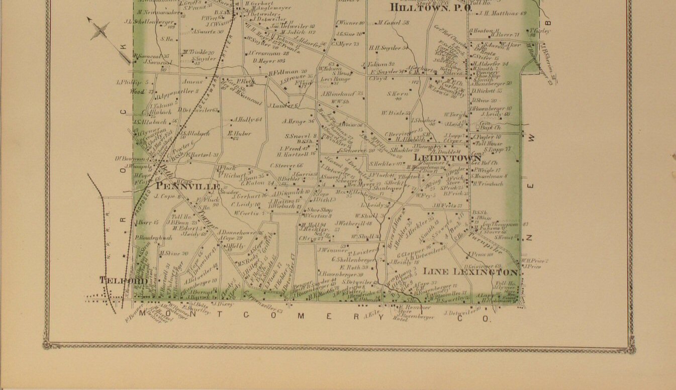
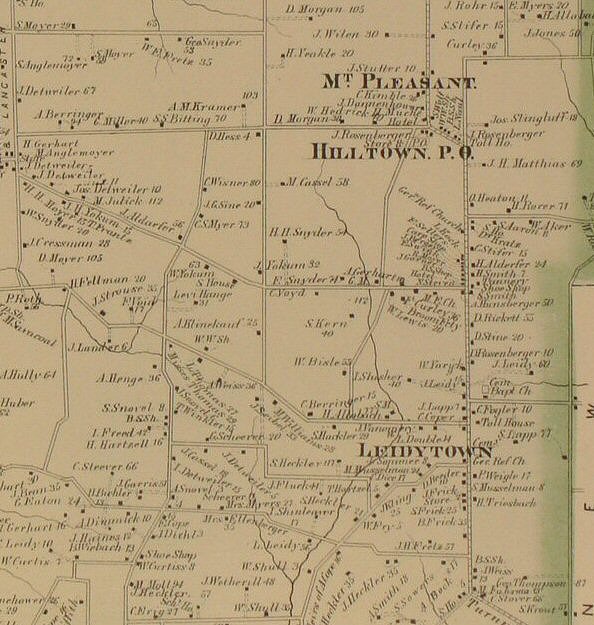
to view close-up section of the map detail. | Hilltown 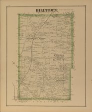
Click
to view top half of map.
Click
to view lower half of map.
Click
to view close-up section of the map detail. |
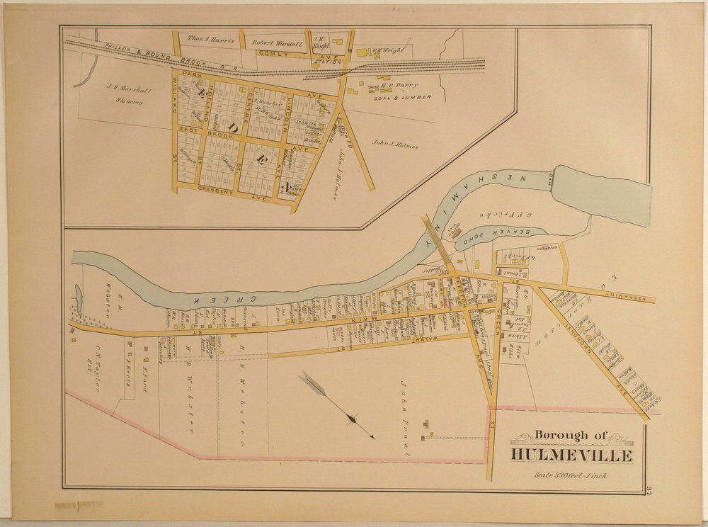
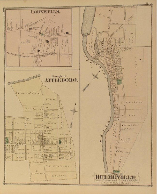
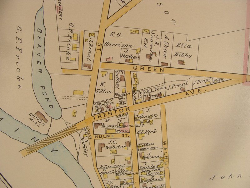
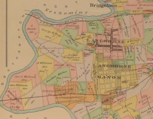
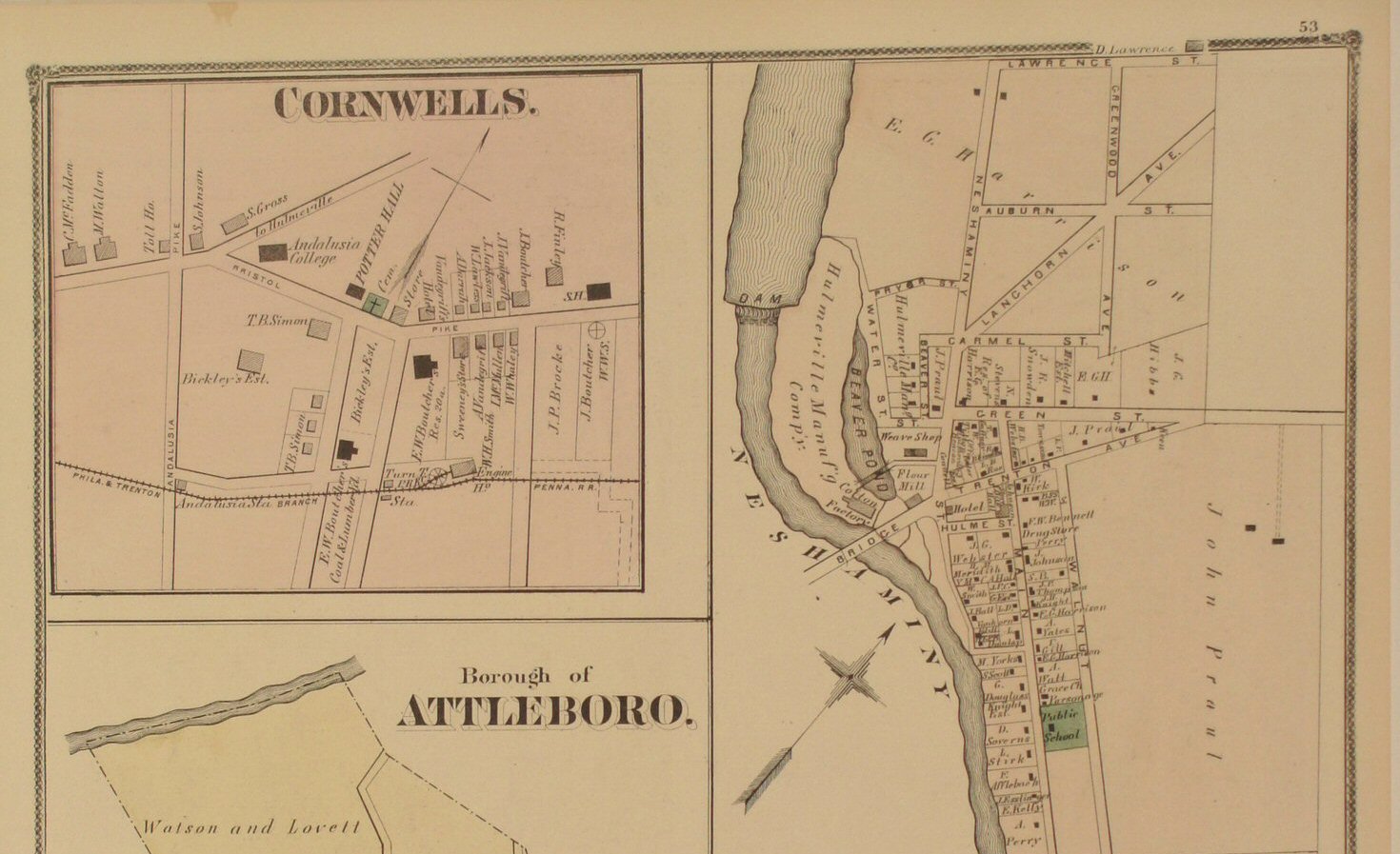
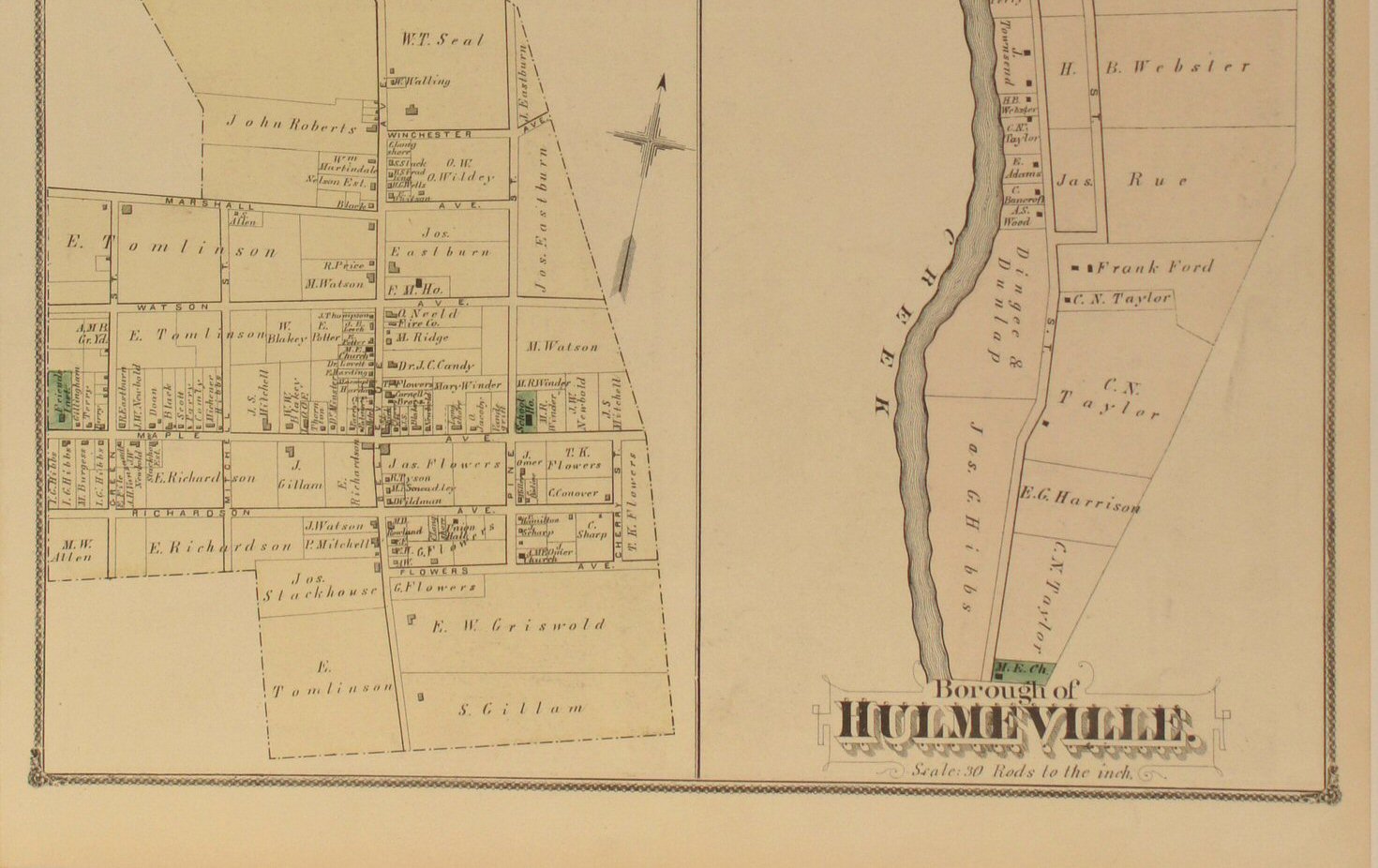
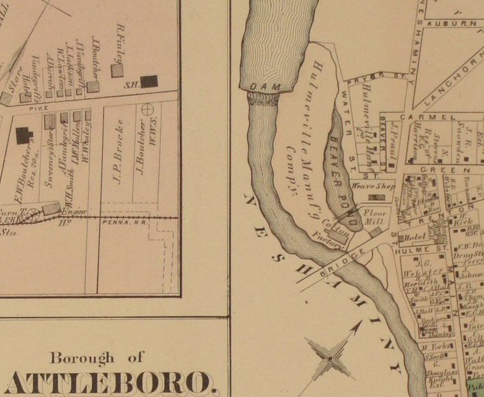
Hulmeville
Boro 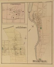
Click
to view top half of map &
Click
to view lower half of map.
Click
to view close-up section
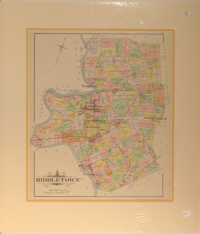
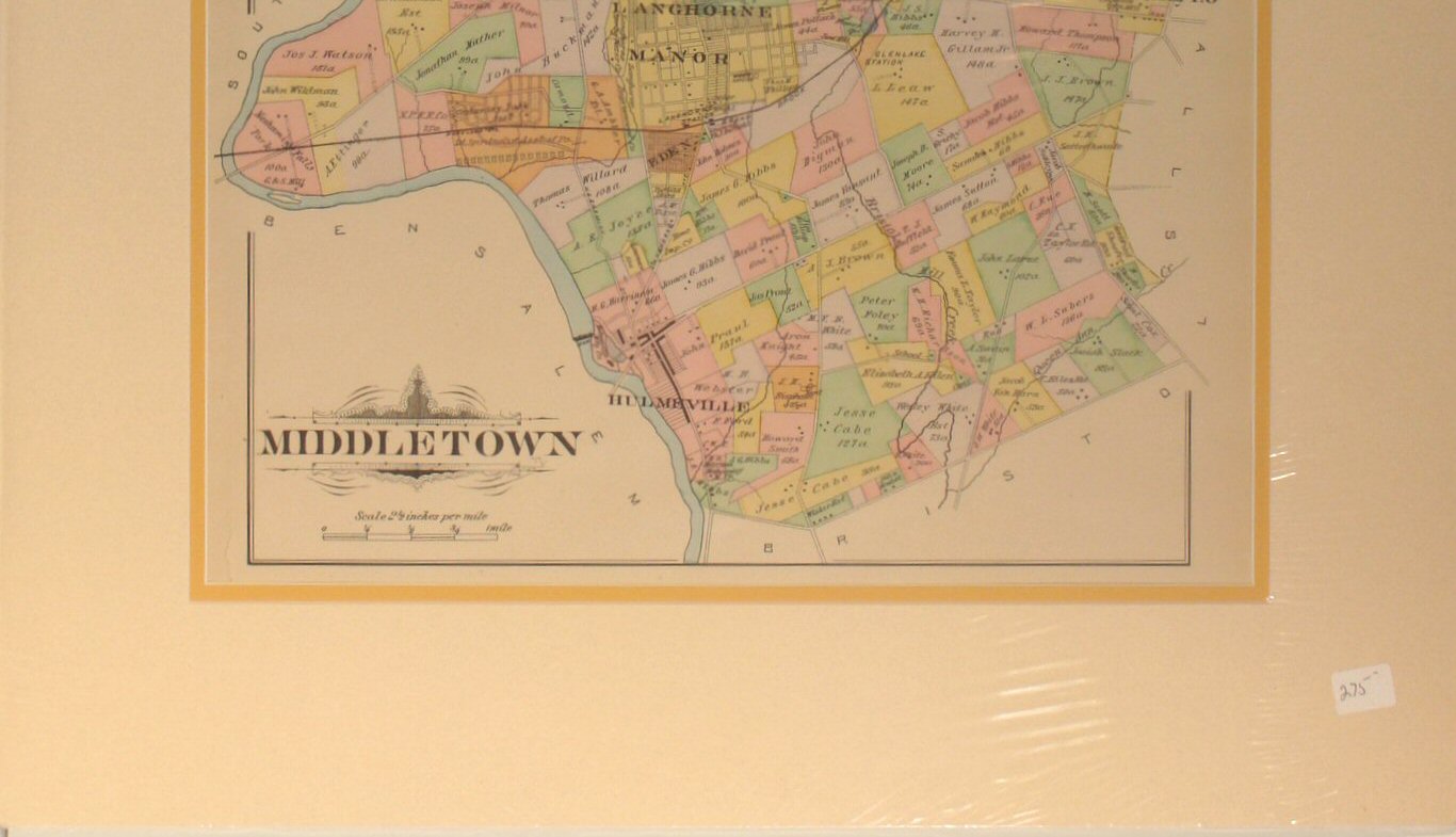
of the map detail. | Middletown (to
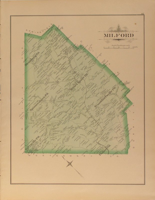
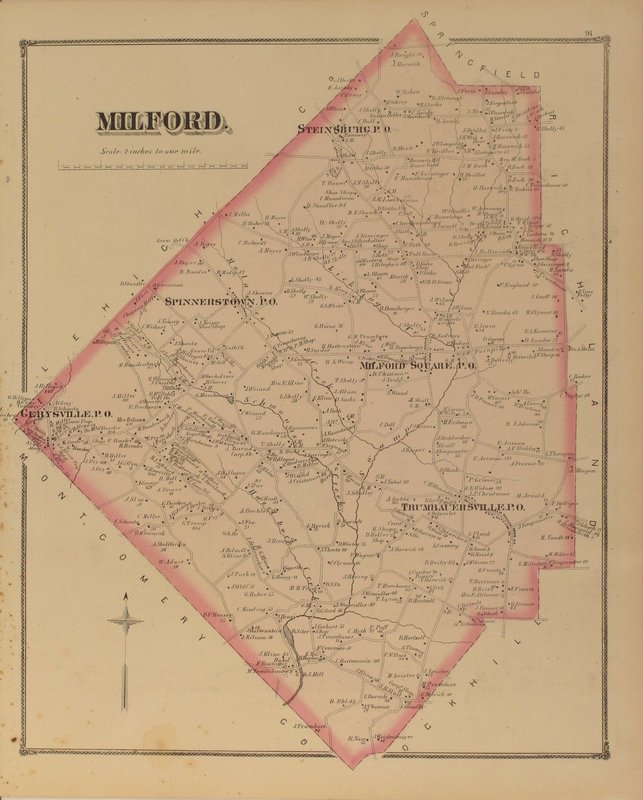
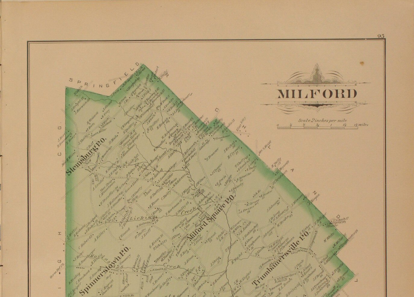
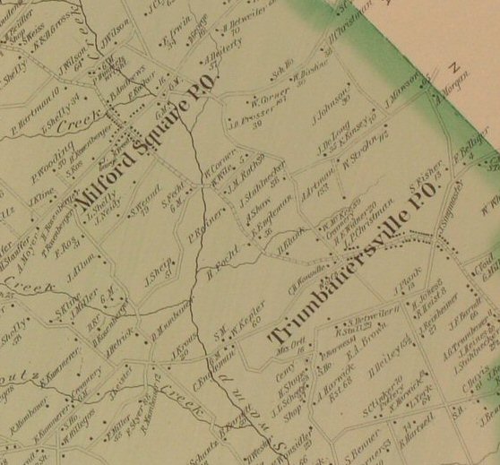
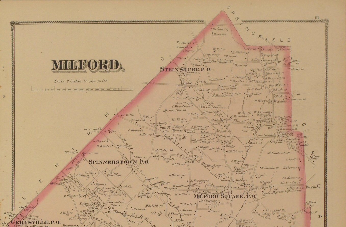
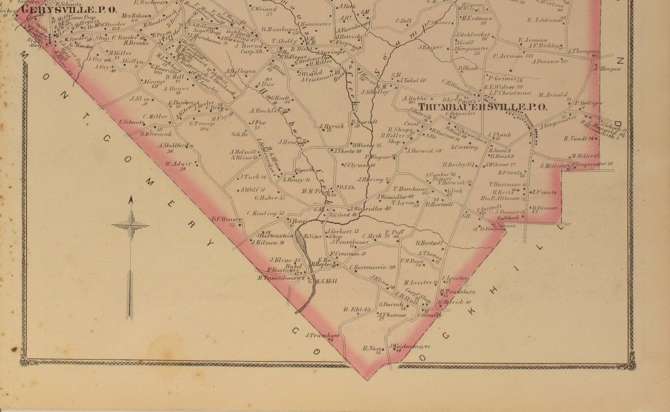
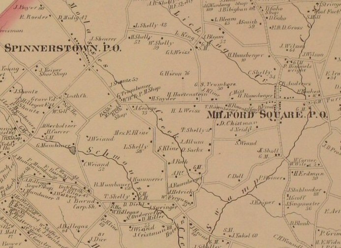
be added...please check back) | Milford 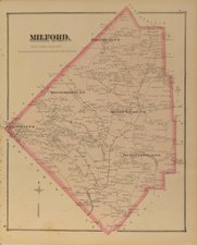
Click
to view top half of map &
Click
to view lower half of map.
Click
to view close-up section of the map detail. |
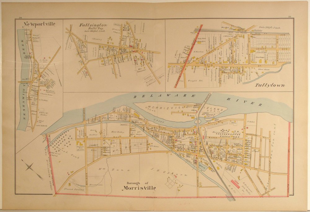
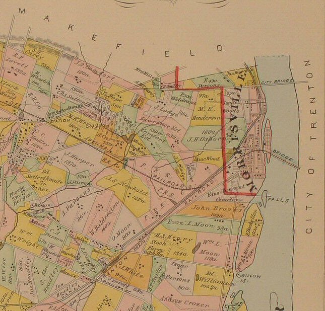
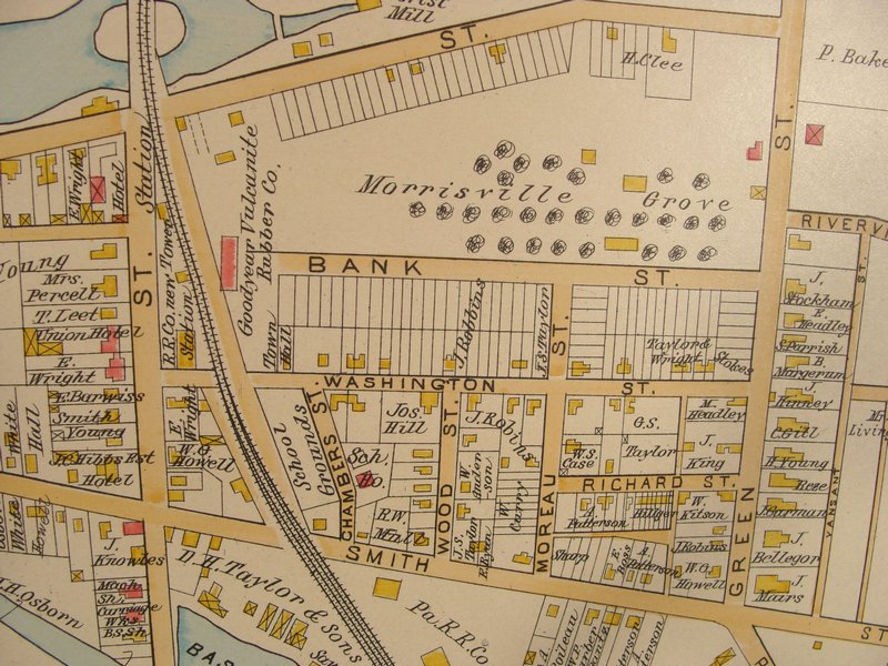
Morrisville
Boro (to
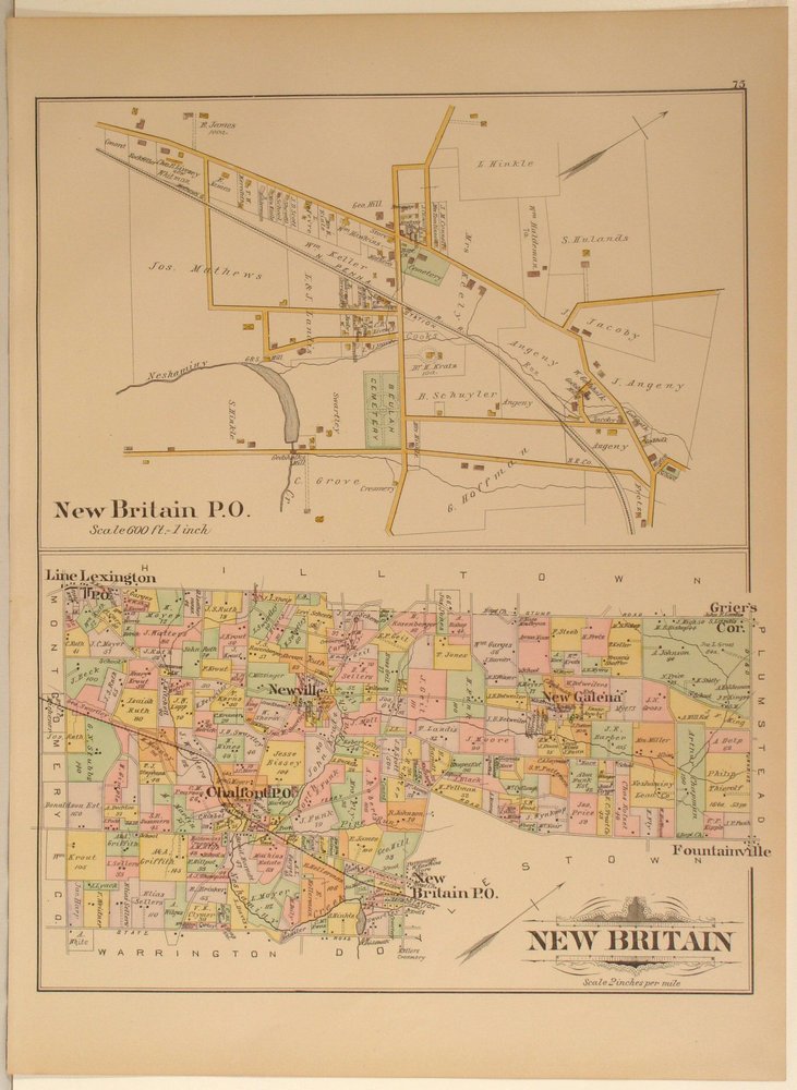
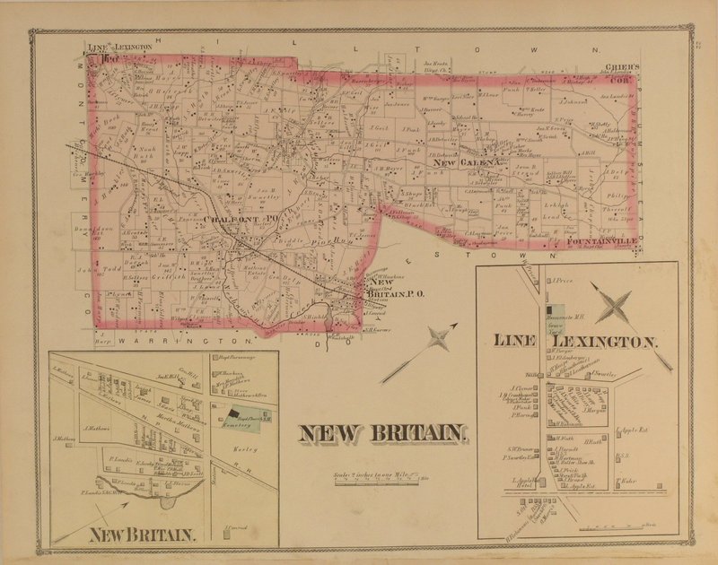
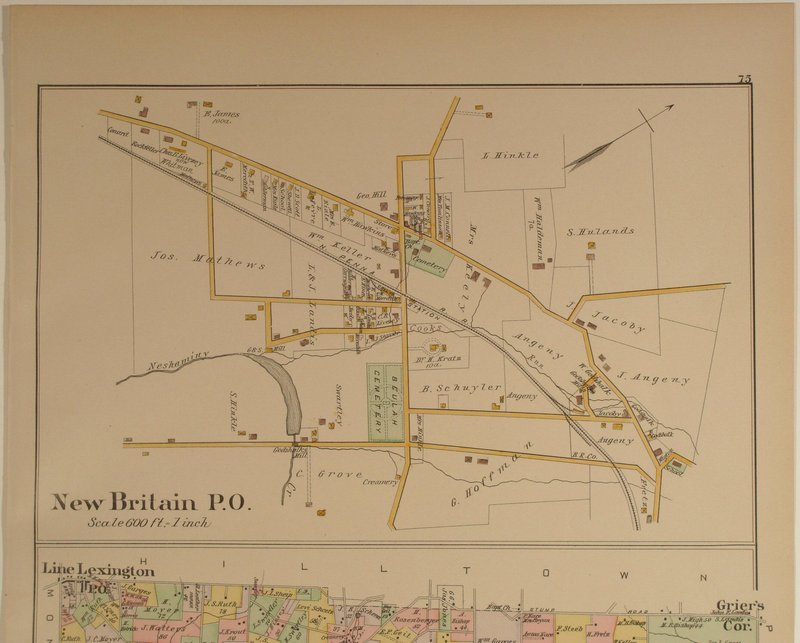
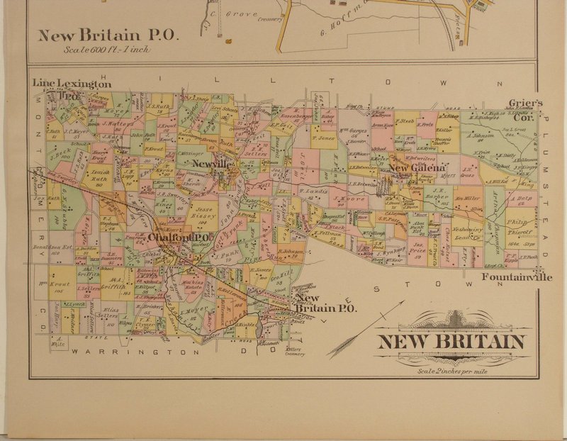
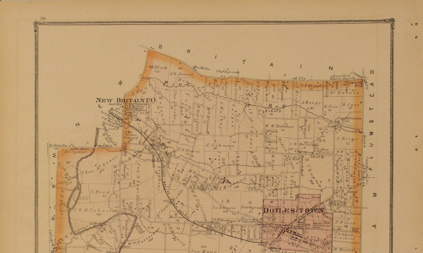
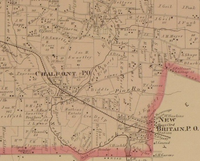
be added...please check back) | New
Britain 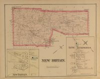
Click
to view close-up section of the map detail. | New
Hope Boro (to
be added...please check back) |
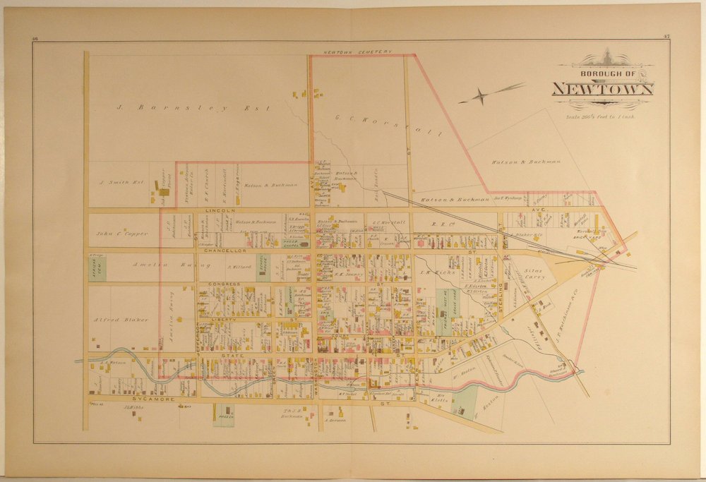
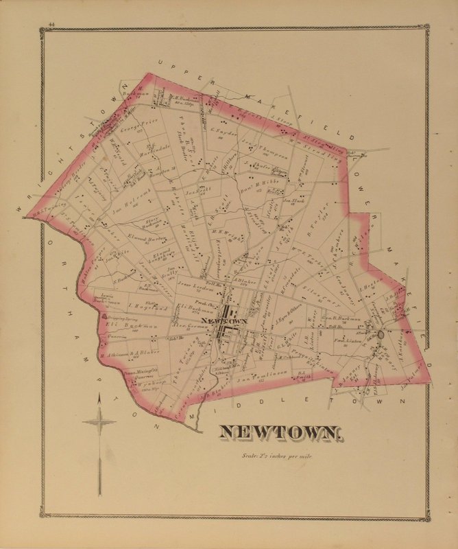
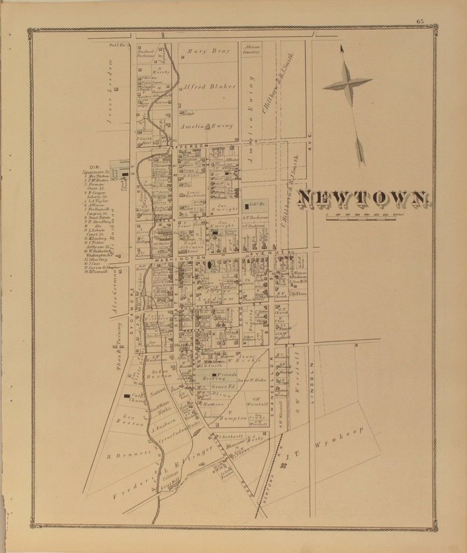
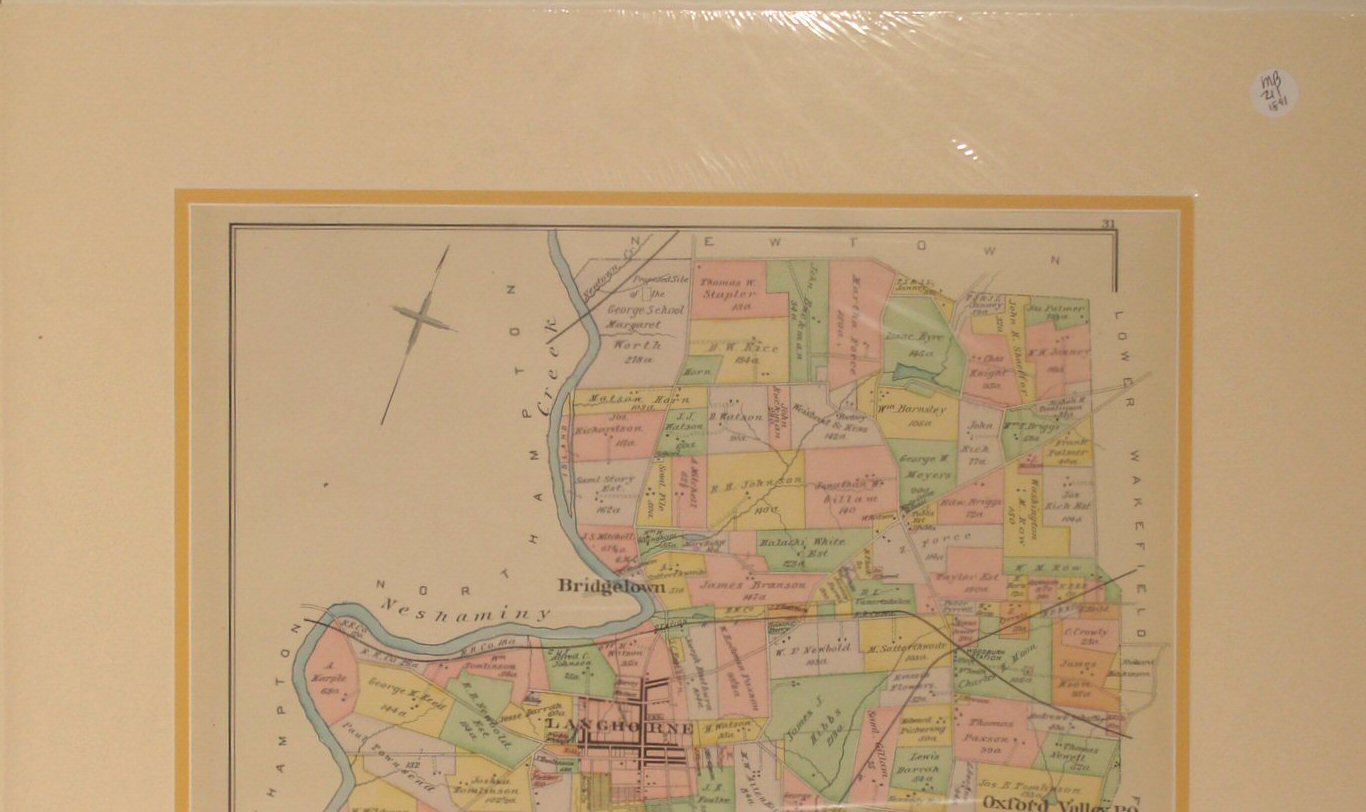
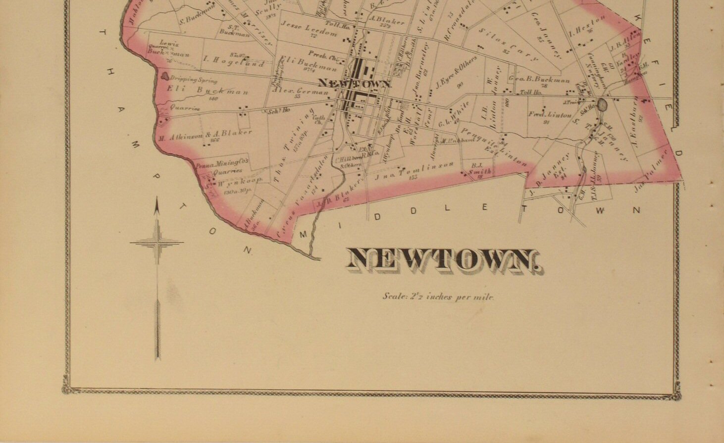
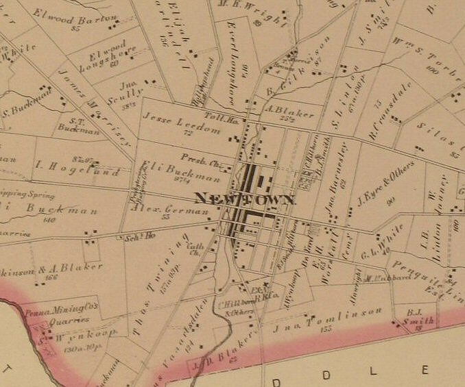
Newtown 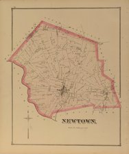
Click
to view top half of map.
Click
to view lower half of map.
Click
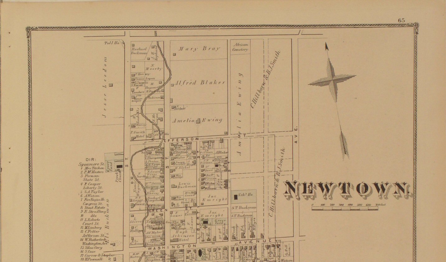
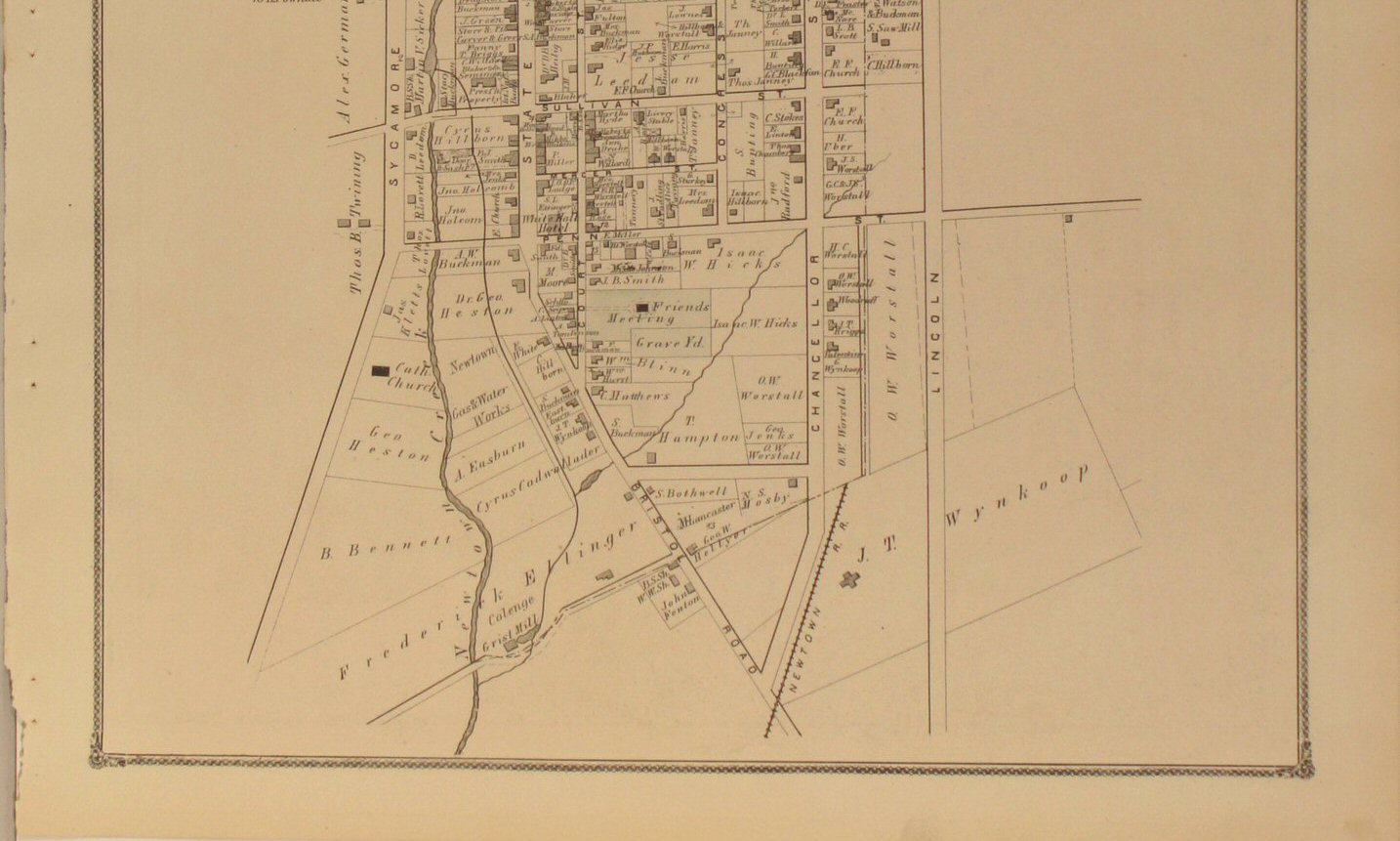
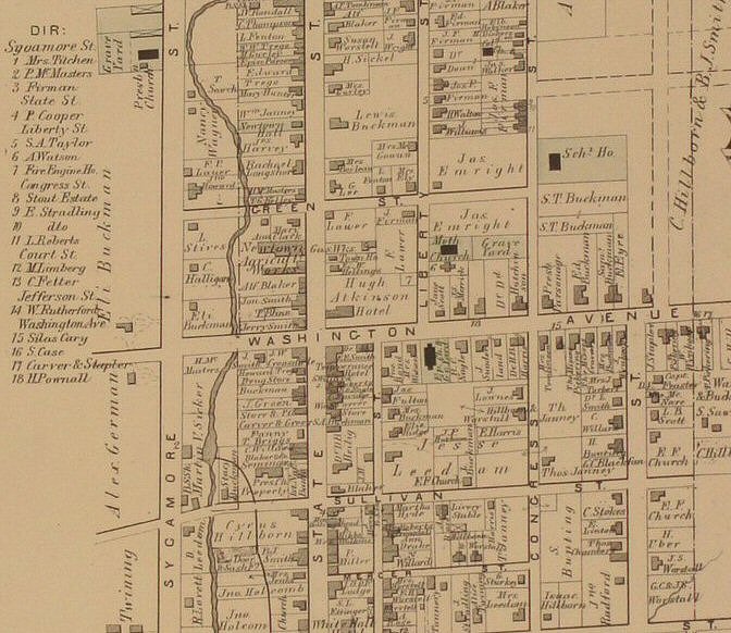
to view close-up section of the map detail. | Newtown
Boro 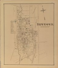
Click
to view top half of map.
Click
to view lower half of map.
Click
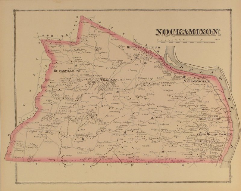
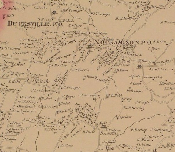
to view close-up section of the map detail. | Nockamixon 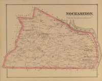
Click
to view close-up section of the map detail. |
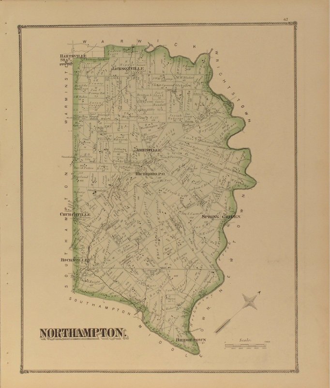
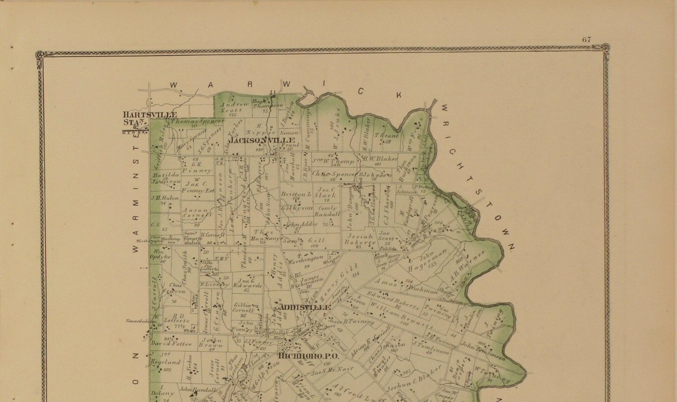
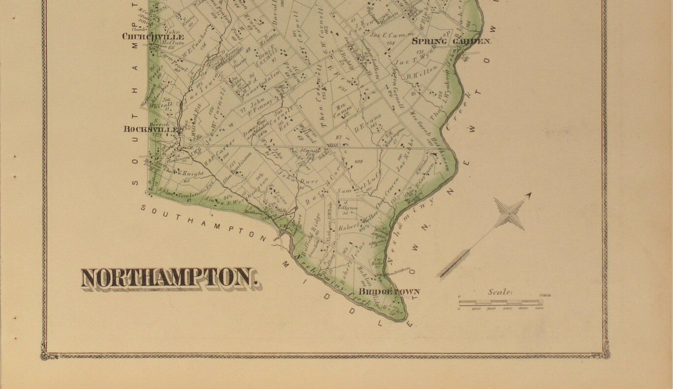
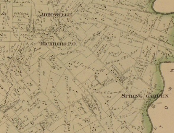
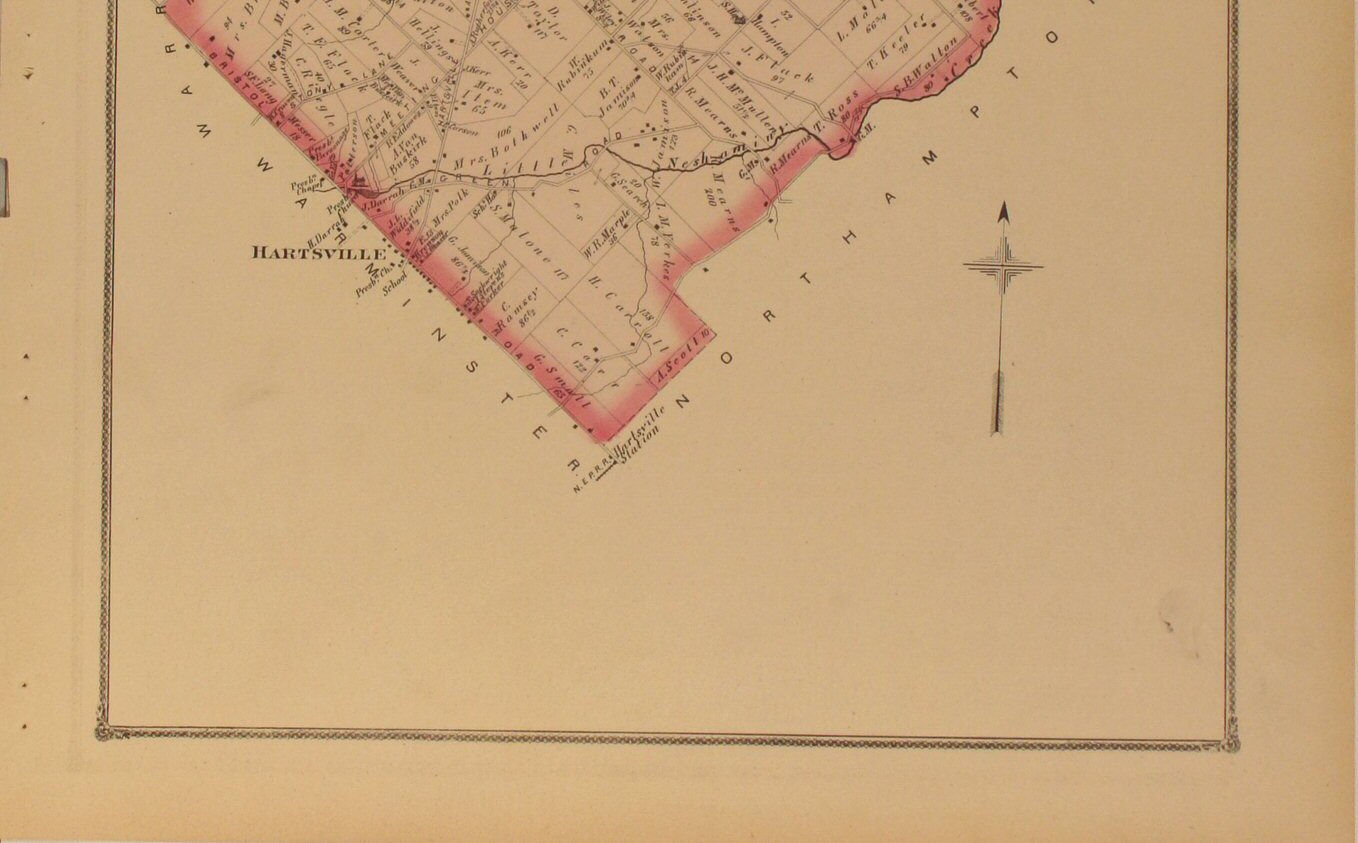
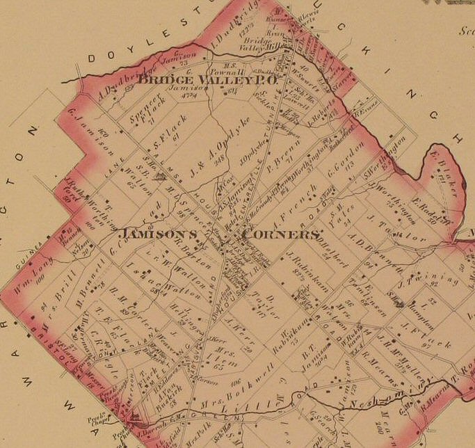
Northampton 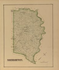
Click
to view top half of map.
Click
to view lower half of map. Click
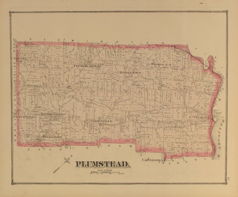
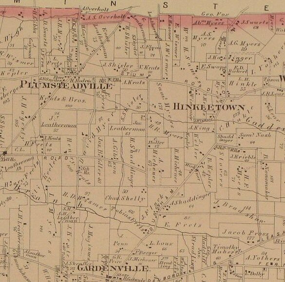
to view close-up section of the map detail. | Plumstead 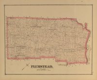
Click
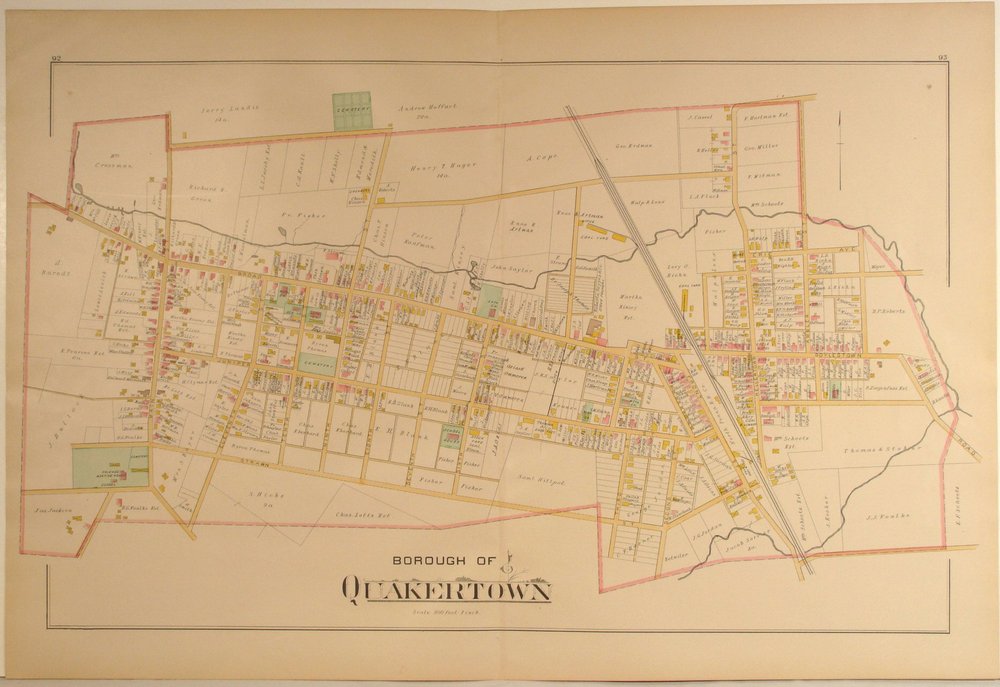
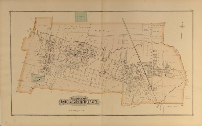
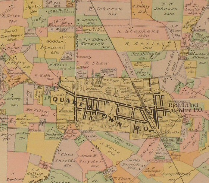
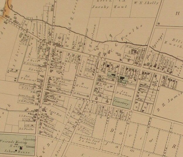
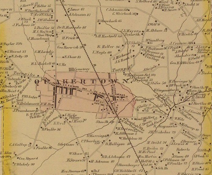
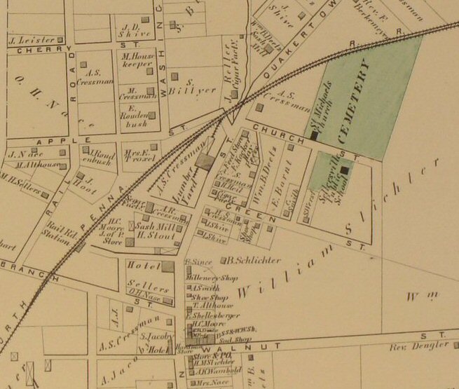
to view close-up section of the map detail. | Quakertown 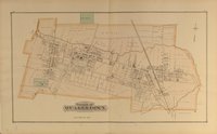
Click
to view close-up section of the map detail. |
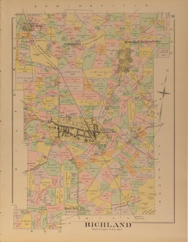
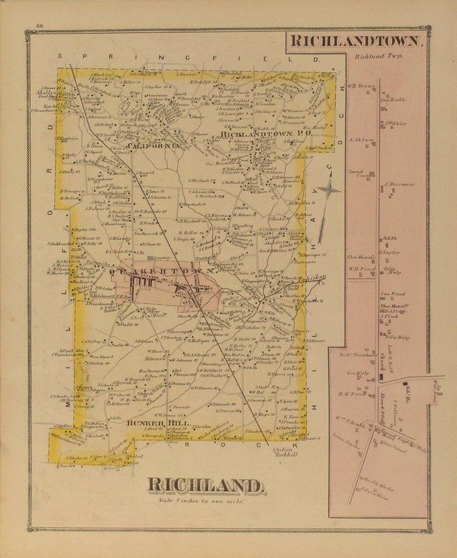
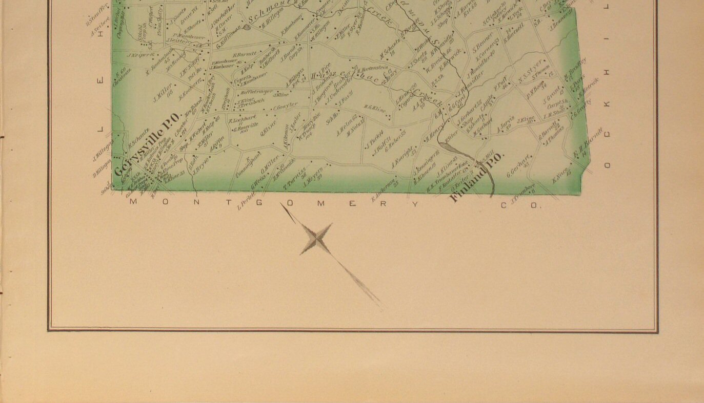
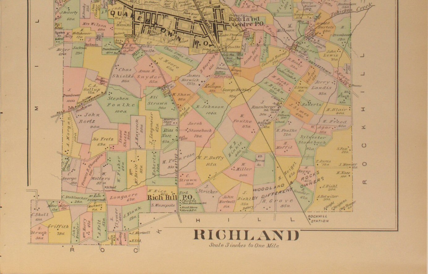
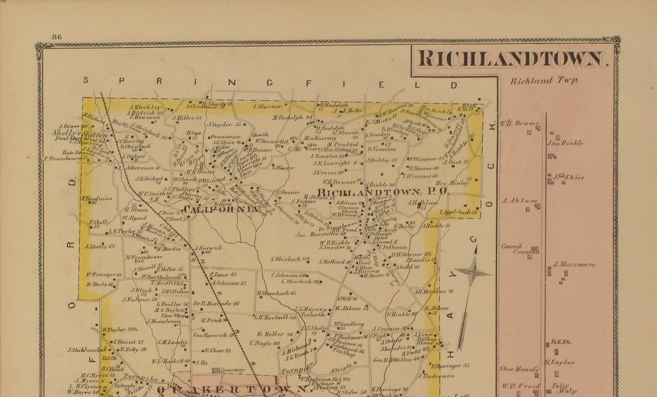
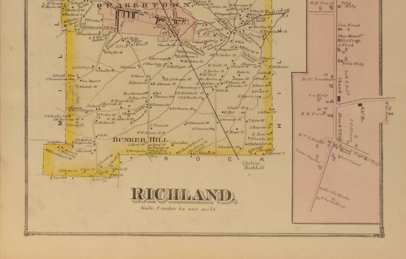
Richland 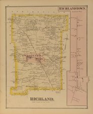
Click
to view top half of map.
Click
to view lower half of map.
Click
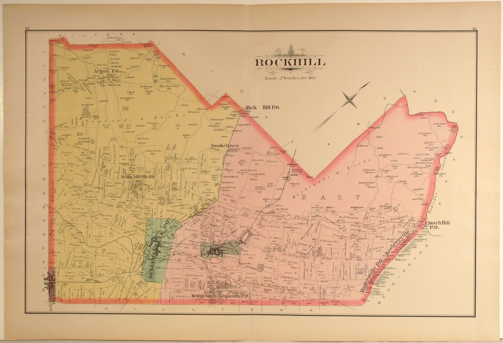
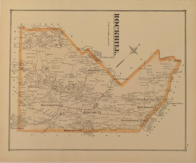
to view close-up section of the map detail. | Rockhill 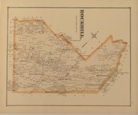
Click
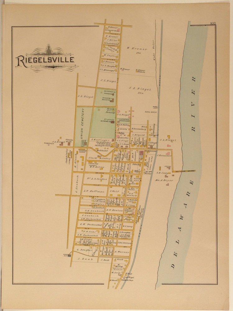
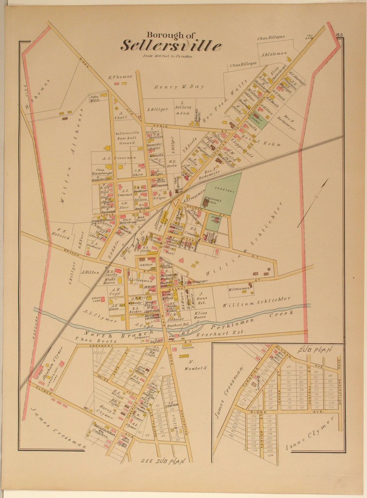
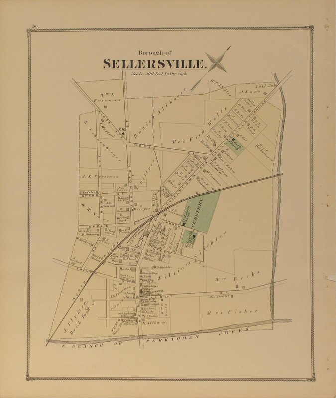
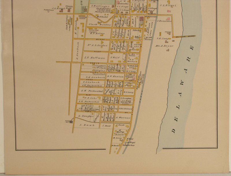
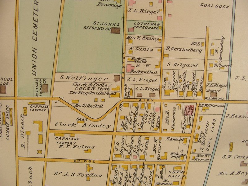
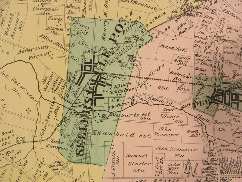
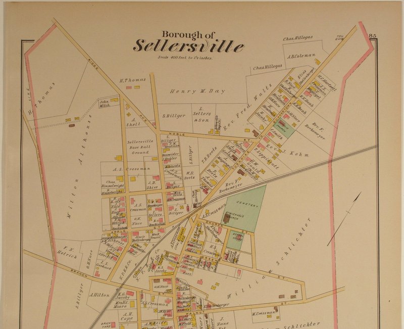
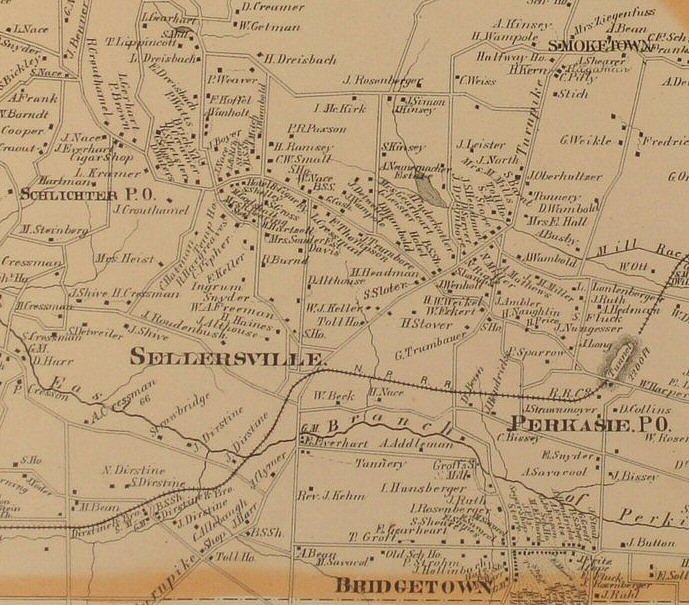
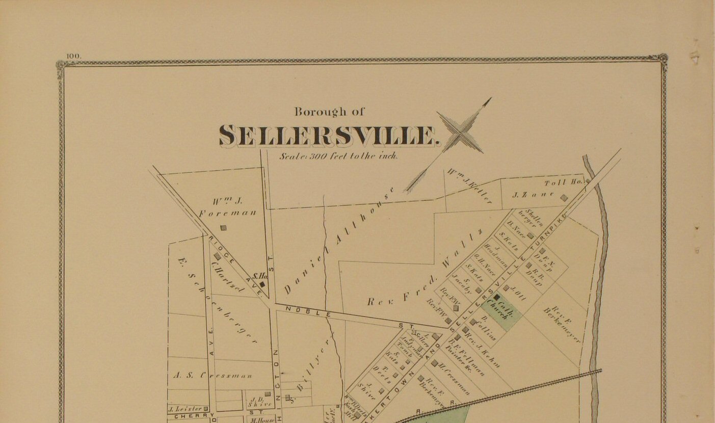
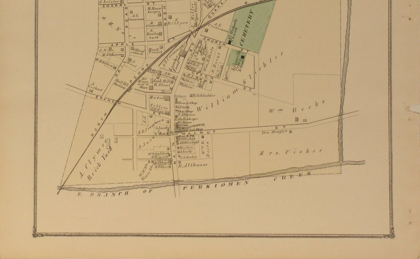
to view close-up section of the map detail. | Sellersville 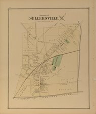
Click
to view top half of map.
Click
to view lower half of map.
Click
to view close-up section of the map detail. |
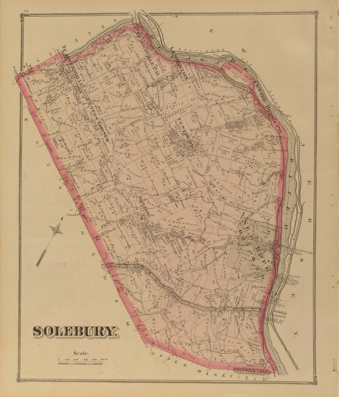
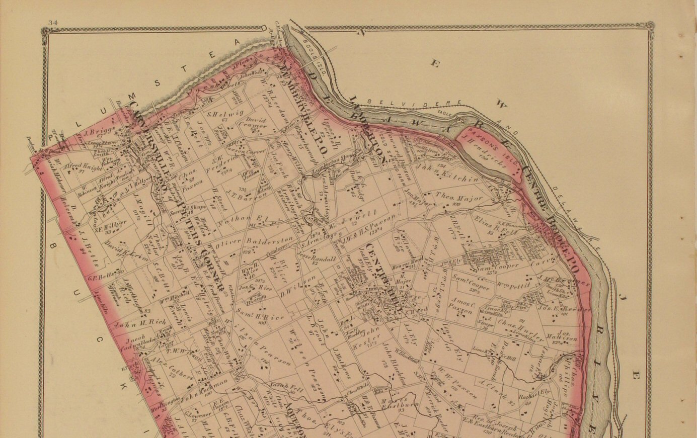
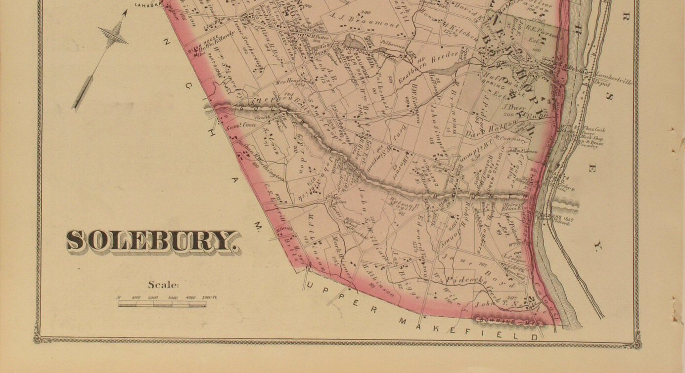
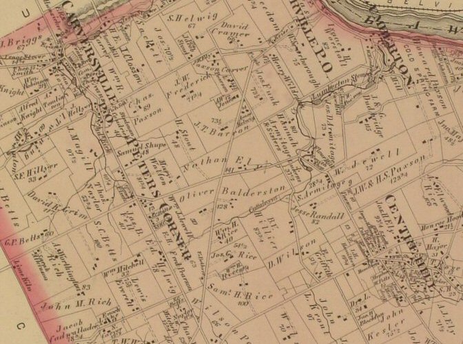
Solebury 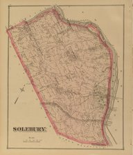
Click
to view top half of map.
Click
to view lower half of map.
Click
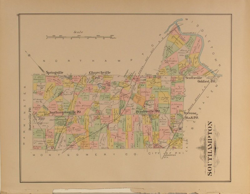
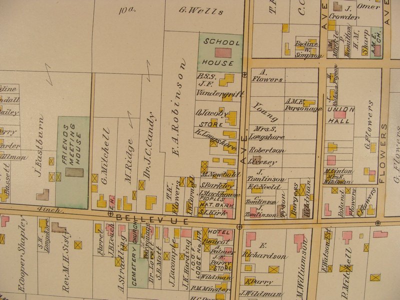
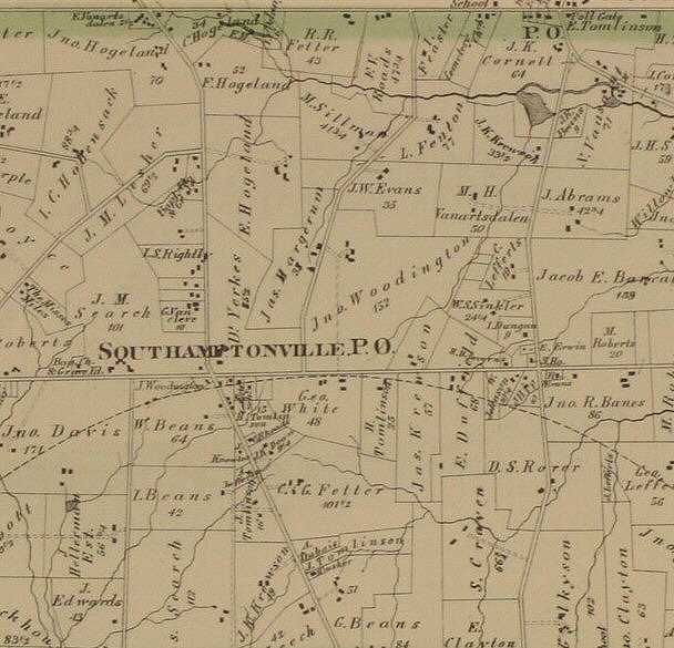
to view close-up section of the map detail. | Southampton 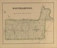
Click
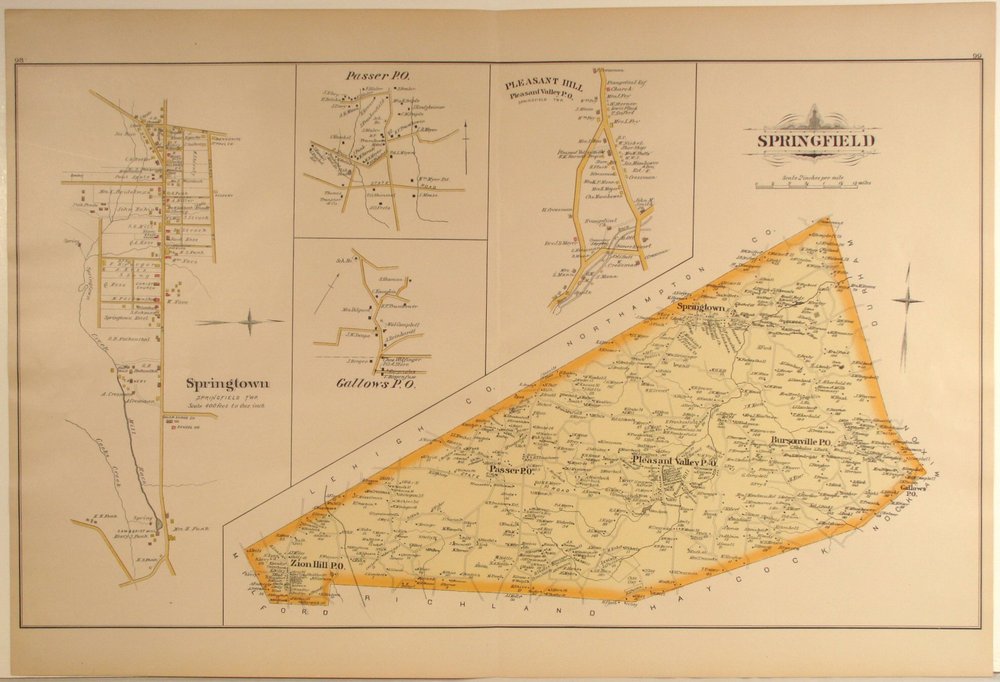
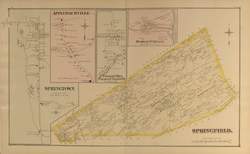
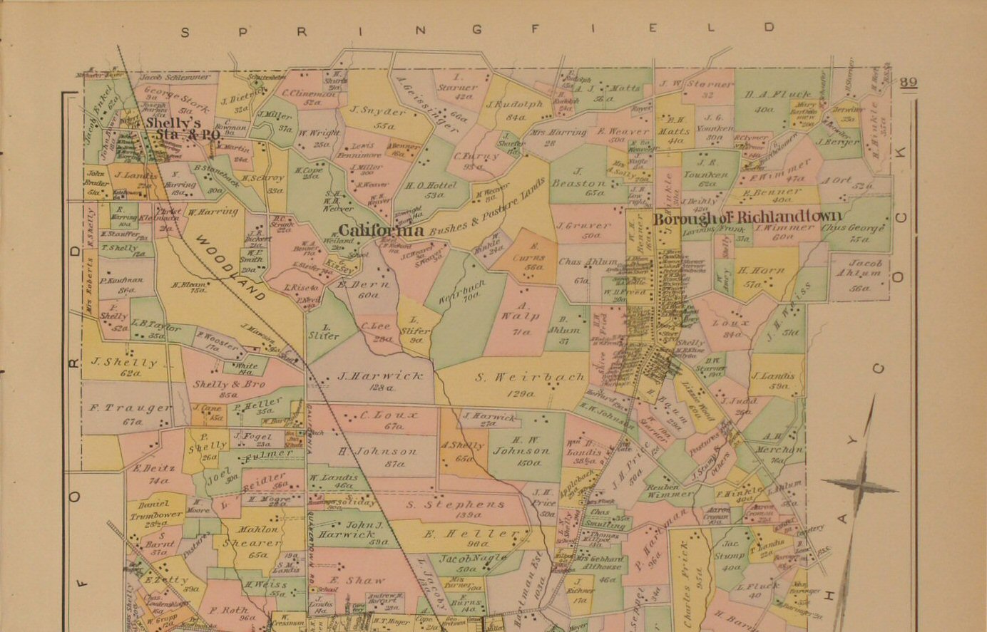
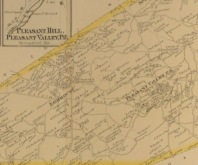
to view a close-up section of the map detail. | Springfield 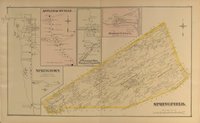
Click
to view close-up section of the map detail. |
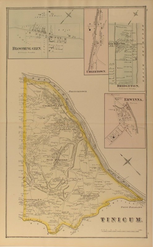
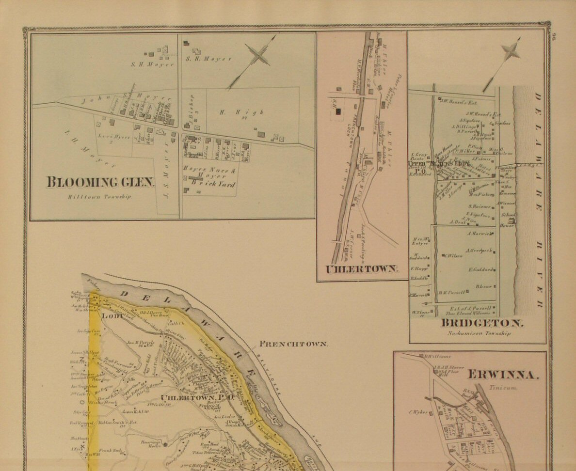
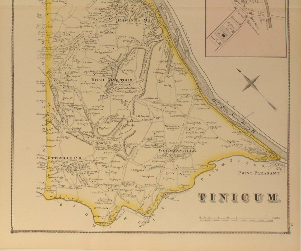
Tinicum 
Click
to view top half of map.
Click
to view lower half of map.
Click
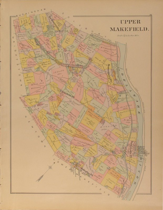
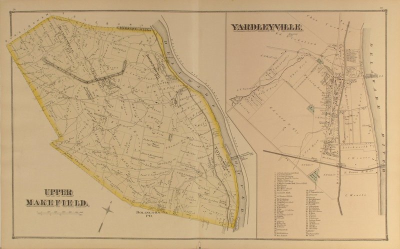
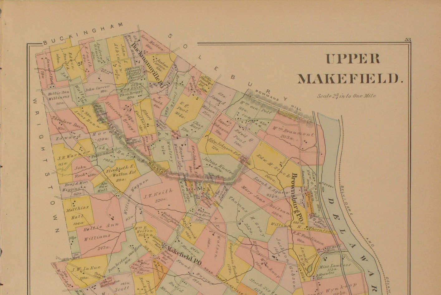
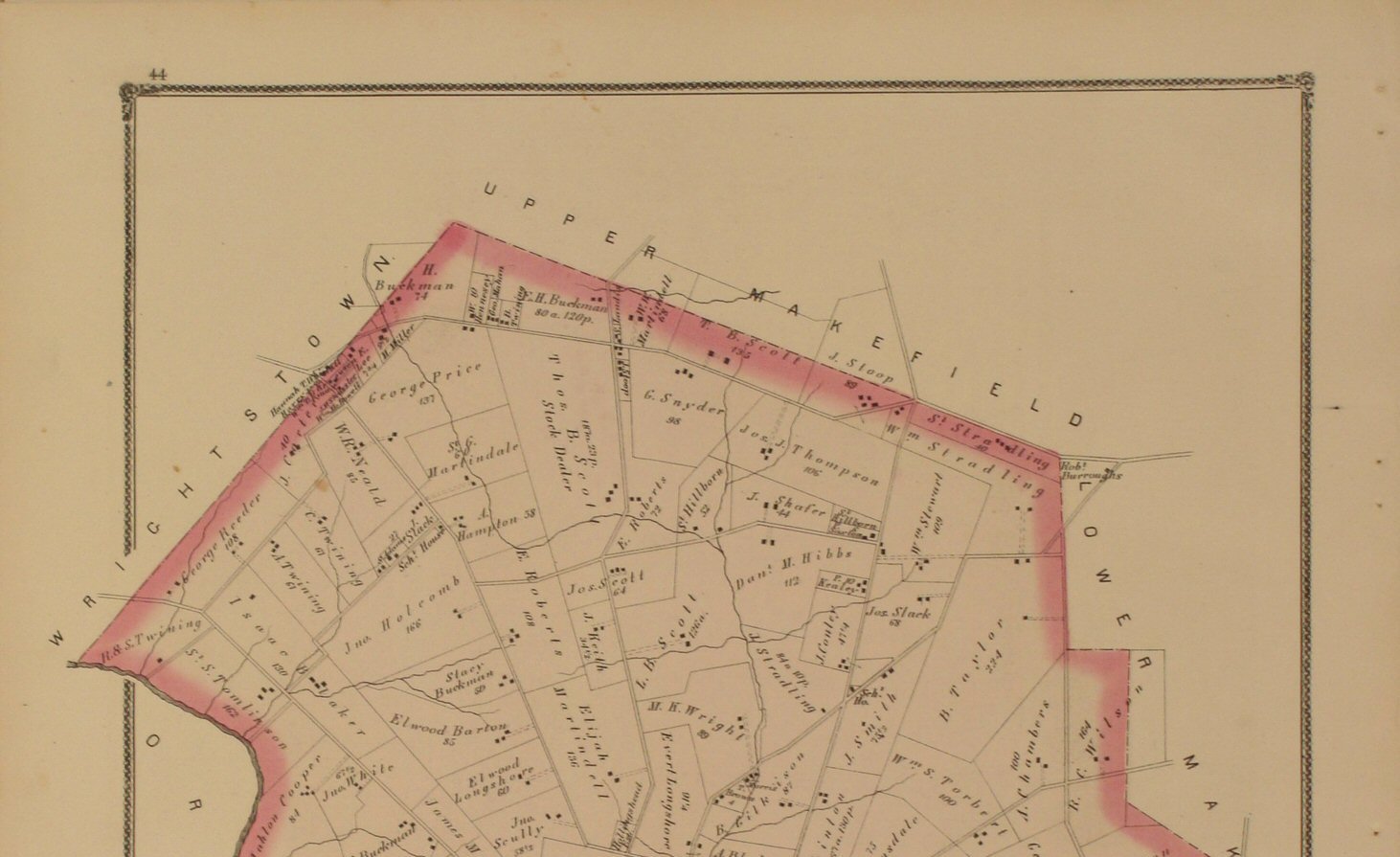
to view close-up section of the map detail. | Upper
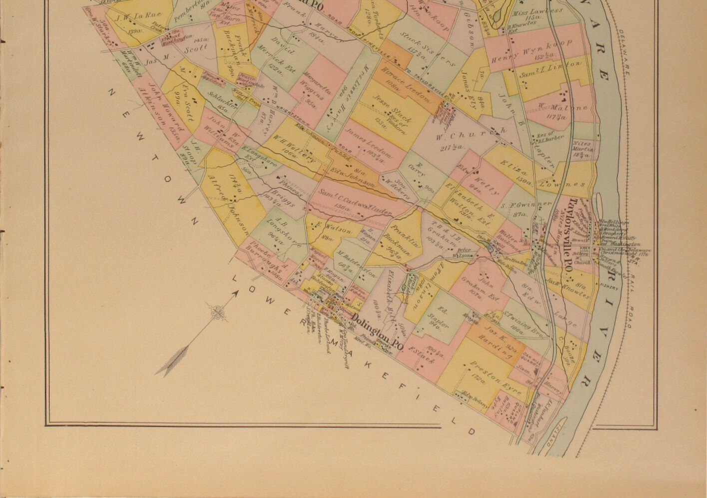
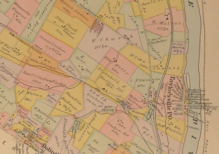
Makefield 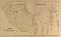
Click to view close-up
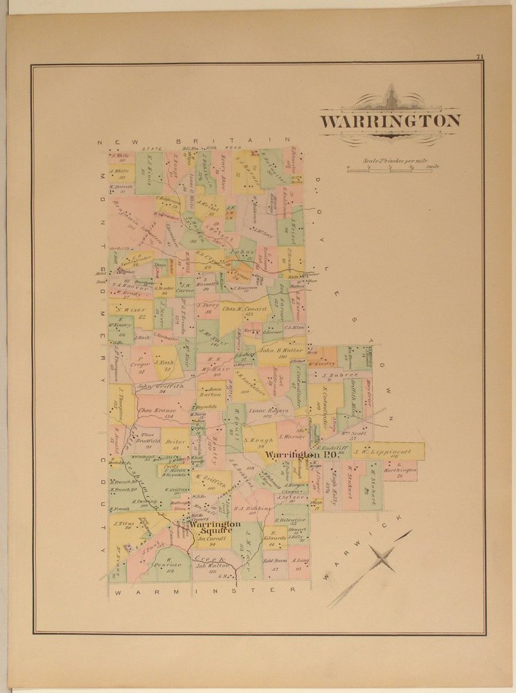
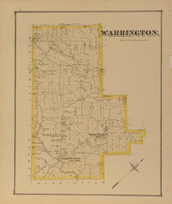
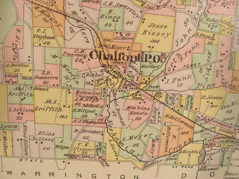
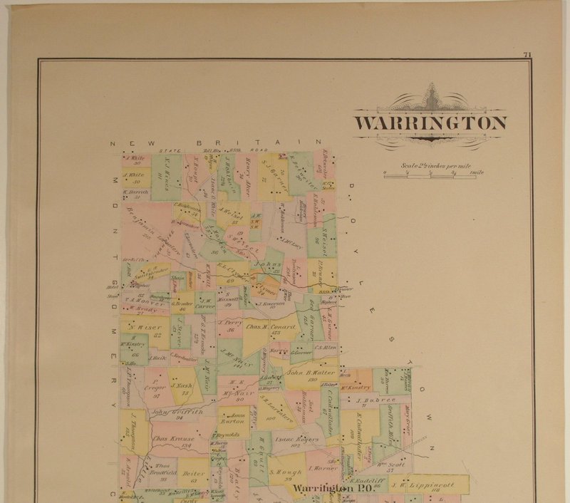
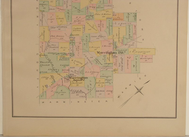
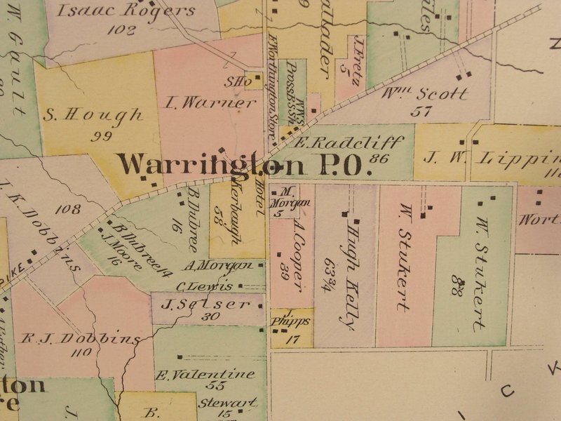
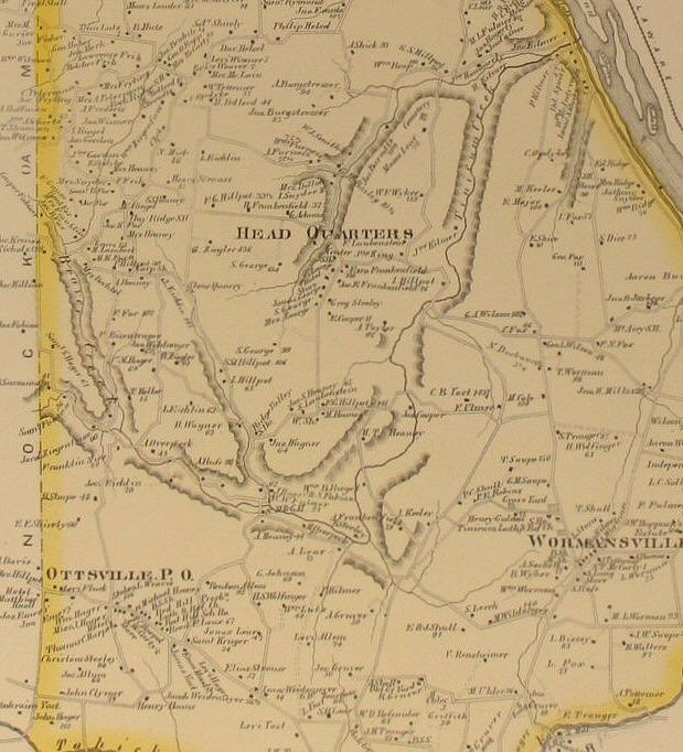
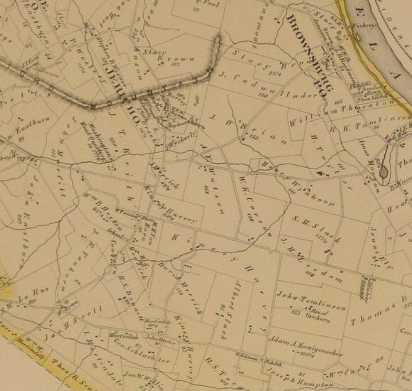
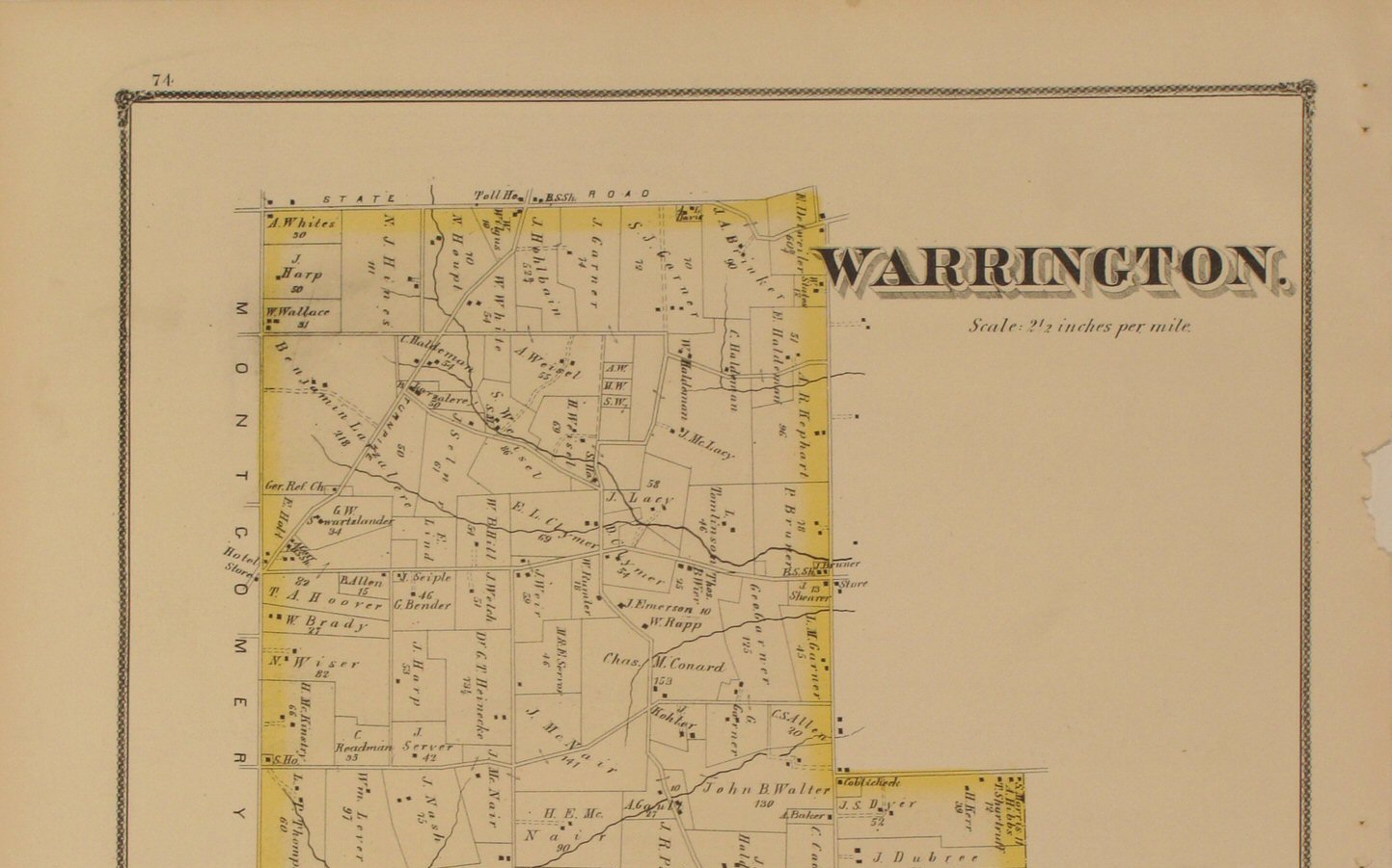
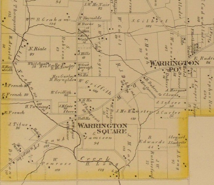
section of the map detail. | Warrington 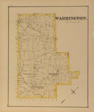
Click
to view top half of map.
Click
to view lower half of map.
Click
to view close-up section of the map detail. |
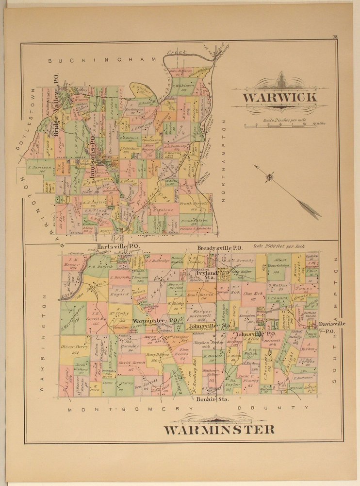
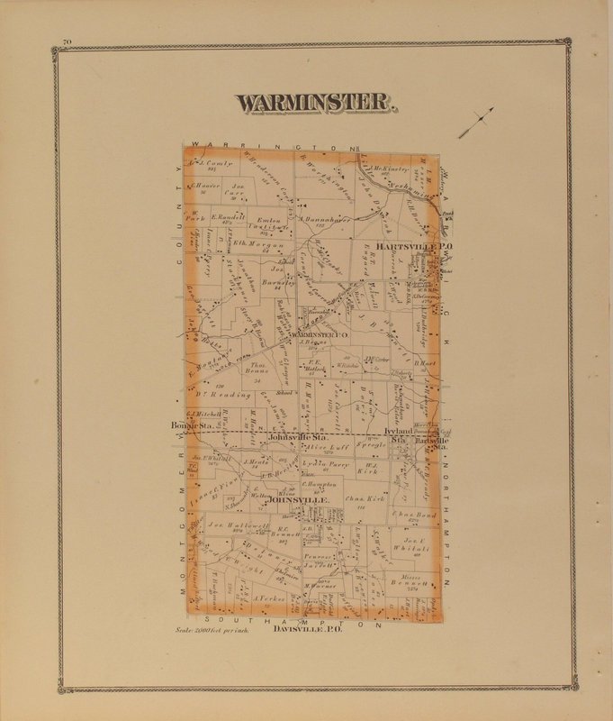
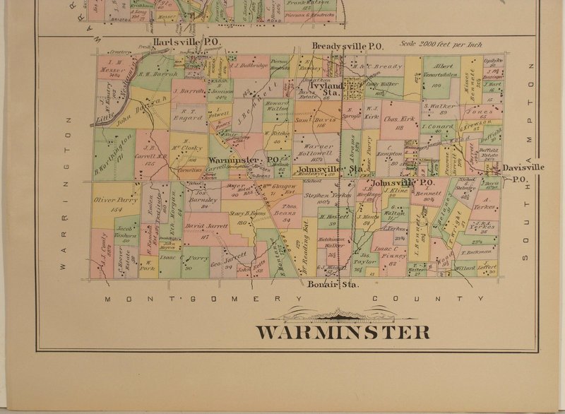
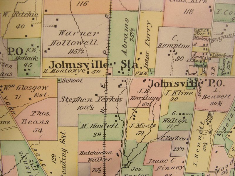
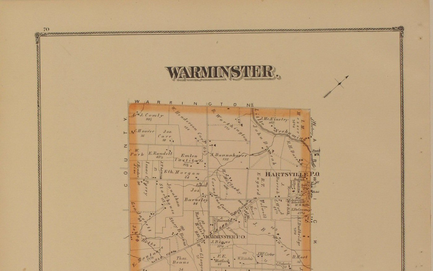
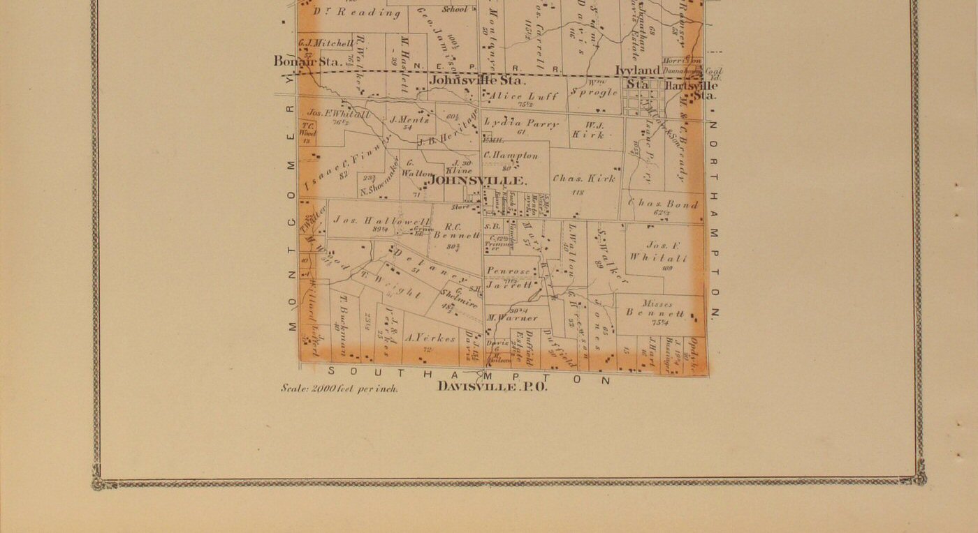
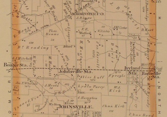
Warminster 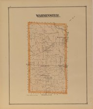
Click
to view top half of map &
Click
to view lower half of map.
Click
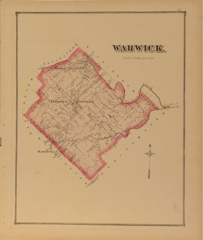
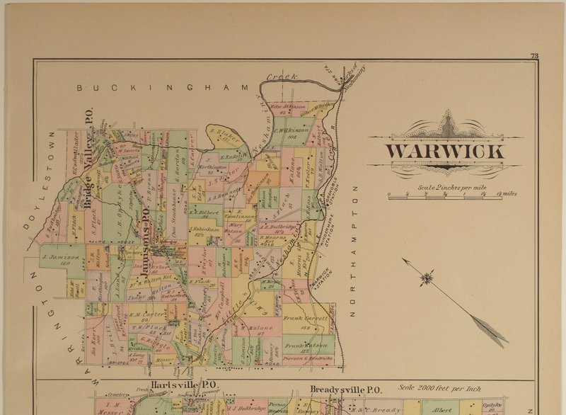
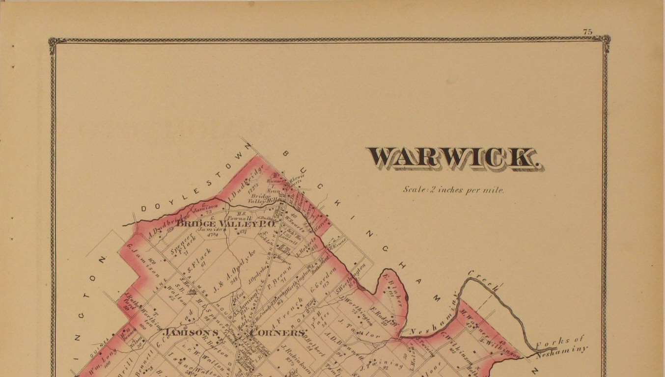
to view close-up section of the map detail. | Warwick 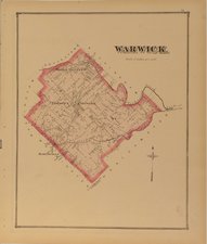
Click
to view top half of map &
Click
to view lower half of map.
Click
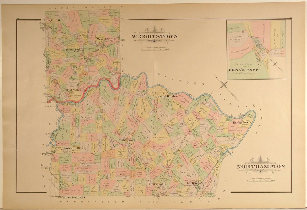
to view close-up section of the map detail. | Wrightstown (to
be added...please check back) |
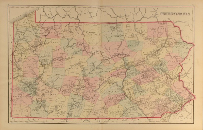
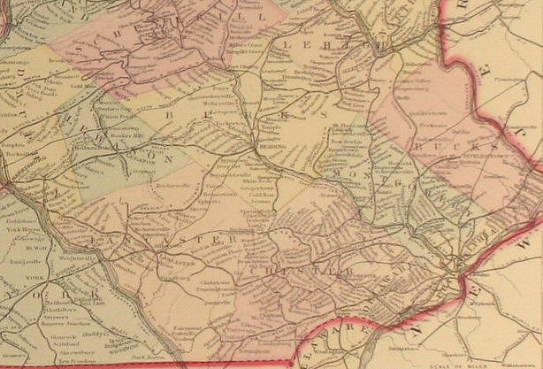
PA
Map 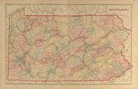
Click
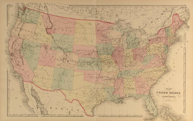
to view close-up section of the map detail. | U.S.
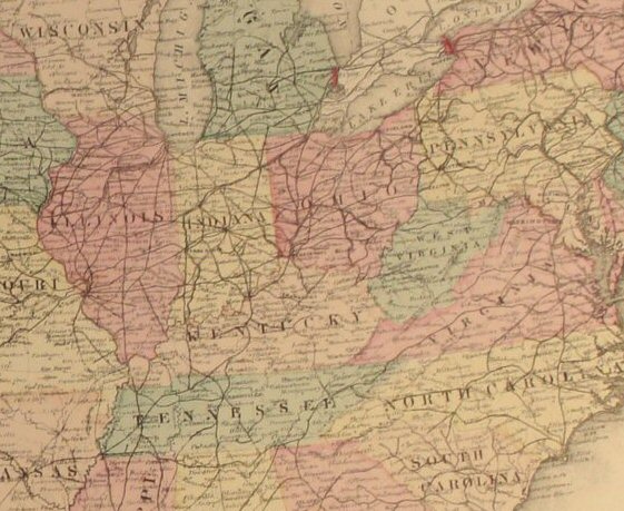
Map 
Click
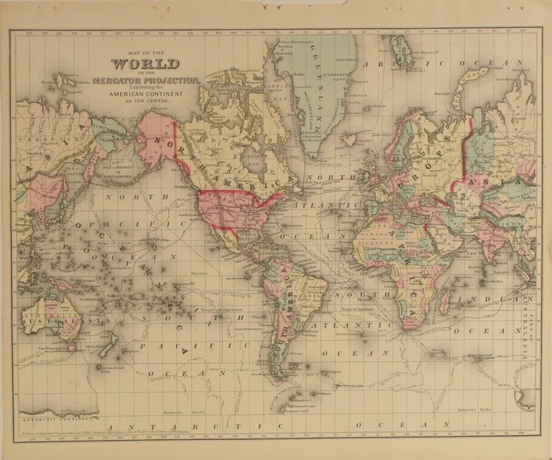
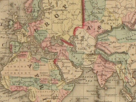
to view close-up section of the map detail. | World
Map 
Click
to view close-up section of the map detail. |


